variable recession rates. No erosion was mea-
Recession has centered around a cratered drain-
sured on Racine Island or Area B in 1994. Field
ageway that has become incised and enlarged.
observations in Area B showed that slopes are
Two additional drainages, Coastal 6 and Bread
heavily vegetated and more gently sloping than
Truck, exhibit variable head and lateral recession
in other sections of ERF. Lateral erosion in 1994
rates characteristic of ERF (Fig. 50c and 50d). Bread
also had values ranging from 0 to 3.7 m (Table
Truck Gully receded headward 03.5 m (up to 1.9
14). The greatest change measured thus far was
m/year) and laterally 08.2 m since monitoring
the extension of a shallow (0.5 m) gully by nearly
began in 1993 (Table 14). Coastal 6 Gully receded
45 m into the mudflats near Lawson's Pond dur-
02.8 m headward and 01.2 m laterally in a single
ing the 199293 winter (Fig. 50e); little change has
summer season of 1994. Upwards of 1.9 m of
been observed since that time.
headward and 1.2 m of lateral recession occurred
Recession by lateral erosion characterizes the
here in early fall.
B-Gully site, located about 75 m below the head-
Rapid lateral erosion of about 3.7 m was re-
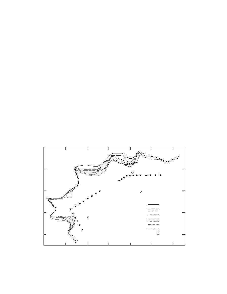
wall (Fig. 50a). Erosion forms cuspate embayments
corded at River Section-North between July and
that gradually enlarge, with a maximum measured
November of 1994 (Fig. 53). Erosion takes place
recession of 8.2 m (Fig. 52). This site is significant
along large rotational slumps that are undercut
because WP has been found in gully transport,
by the river (Fig. 54). To start, large extension
but additional study is needed to see if WP is
cracks develop parallel to the scarp, gradually
being flushed out of C-Pond or introduced by
leading to catastrophic failure. The location of the
erosion and collapse of these bank sediments.
crack becomes the new scarp of the riverbank.
Parachute Gully (Fig. 50b) is a good example
Several locations where the river is meandering
of the processes of headward erosion and reces-
and slope processes are consuming mudflat sedi-
sion. Up to 9.3 m of headward recession (~3.79
ments are given in Figure 55. Material at these
m/year; Table 14) but only 1.6 m of lateral reces-
sites is entering directly into the Eagle River and
sion have been monitored at this site since 1992.
subsequently into Knik Arm.
B
123
131
120
102
132
27 Jun 1992
22 Sep 1992
43
02 Jun 1993
26 Aug 1993
A
22 Sep 1993
14 May 1994
17 Sep 1994
12 Nov 1994
92
Hub Stake
Line Stake
a. B-Gully.
Figure 50. Gully scarp locations for measuring erosion rates.
39


 Previous Page
