a
ask
Alaska
ICELAND
r, Al
o
Hab
690
GREENLAND
utch
To D
ORT
OL
Pevek
0
69
a d yr
NORWAY
0
60
SWEDEN
0
600
12
61
1065
600
In
e
Riv
745
520
600
FINLAND
465
635
Murmansk
860
52
5
iver
890
490
Tiksi
r
Dikson
r
River
en
Ol
0
500
LE
RC
CI
Nautical Miles
R
IC
ARCT
0
1000
R
U
S
S
I
A
Kilometers
JAPAN
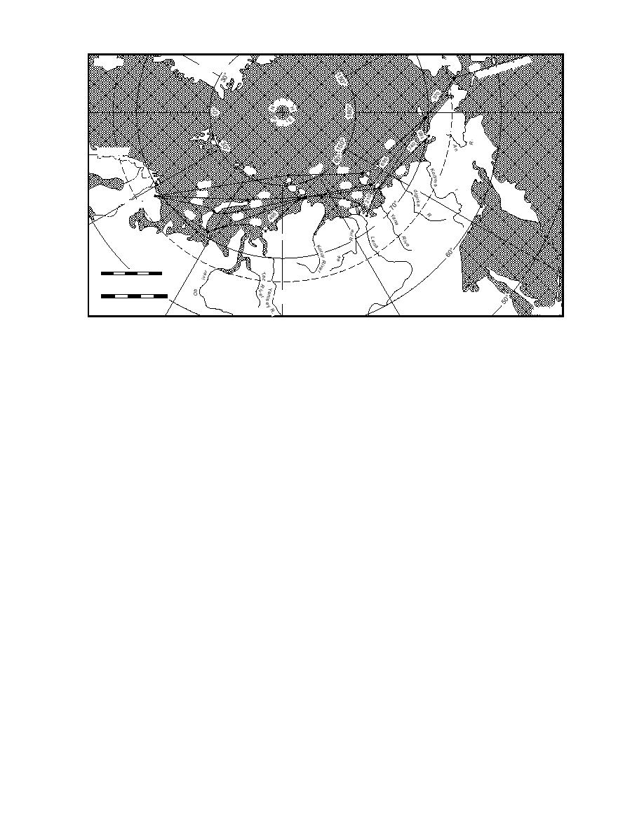
Figure 20. Approximate distances, in nautical miles, of the various route segments between Murmansk and
Dutch Harbor.
The NSR is approached from the west through
region are often the most challenging of any part
the Barents Sea. The islands of Novaya Zemlya
of the route. Much less frequently used are Proliv
separating the Barents and Kara Seas mark the
Shokal'skogo, the strait separating the islands of
westernmost end of the NSR. In addition to the
Bolshevik and Oktyabra'skoy Revolyutsh, and the
high-latitude route around Cape Zheleniya, the
high-latitude route around Cape Arkticheski, the
archipelago's northern tip located at 81N. The
northernmost tip of the archipelago, there are three
navigable passages through this island group that
shortest distance from Murmansk to the Vil'kitskogo
can be used by deep-draft vessels. The southern-
Strait is approximately 1260 nm, around Cape
most two are most commonly used: the straits of
Zheleniya. Following the coastal route, the dis-
Yugorskiy Shar, which lies south of Vaygach Is-
tance from Murmansk to the Vil'kitskogo Strait
land, and Karskiye Varota (the Kara Gate) to the
(through the Kara Gate) is 1510 nm.
island's north. The third, Matochkin Shar, the strait
The East Siberian Sea is usually entered from
that divides Novaya Zemlya proper into two large
the west in one of three ways: 1) the southernmost
islands, was often used over the last 4050 years
passage is the Dmitriya Lapteva Strait, lying be-
as a nuclear test site and is currently closed to
tween Lyakhovskiy Island and the mainland; 2)
shipping (Kjerstad 1994). The shortest distance
the Sannikova Strait, the next further north; and 3)
from Murmansk to the Kara Sea and the western
the high-latitude route to the north of the entire
terminus of the NSR is 465 nm, through the Ma-
archipelago. The straight-line distance between the
tochkin Shar Strait. The greatest distance is 745
Vil'kitskogo Strait and either of these two straits is
nm, around Cape Zheleniya. The average depth
600 nm, and the distance from Murmansk is 1660
of the Kara Sea is 90 m (Hume 1984).
2360 nm.
The NSR enters the Laptev Sea after passing
The Longa Strait, the 75-nm-wide water pas-
through or around the Severnaya Zemlya archi-
sage between Wrangel Island and the Chukotka
pelago. The most often-used passage is also the
mainland, marks the transition from the East Sibe-
southernmost, Vil'kitskogo Strait. It separates the
rian to the Chukchi Sea. The Ayon and the Wrangel
island group from Cape Chelyuskin on the Taymyr
ice massifs in this area usually create some of the
Peninsula. At nearly 78N, Cape Chelyuskin is the
most challenging ice conditions for navigation on
Russian mainland's most northerly point and con-
the entire route. However, the ice within the strait
sequently the weather and ice conditions in this
is nearly always more navigable than it is to the
31


 Previous Page
