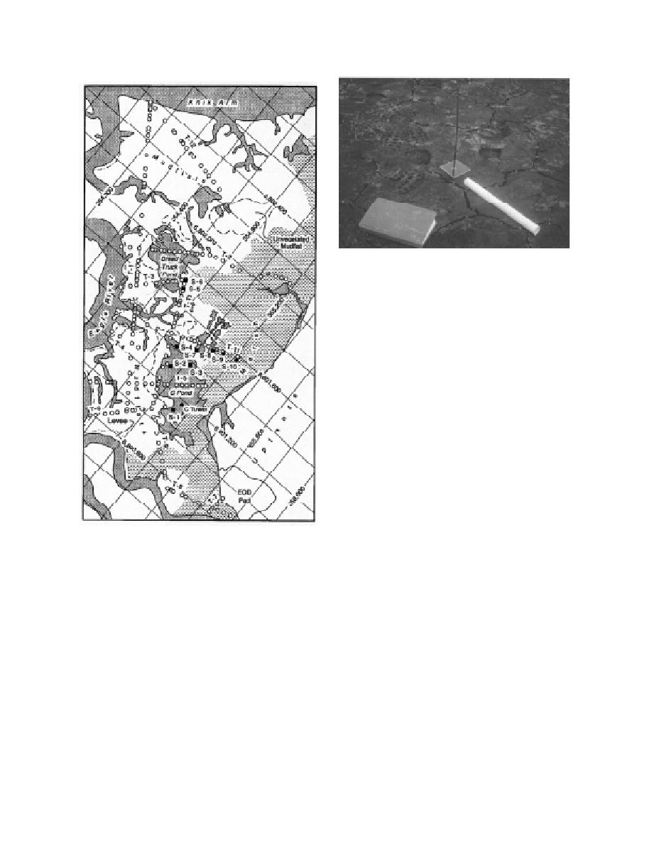
Figure 5. Sedimentation stakes. The plate slides freely
on the rod. Wire flags mark an area of painted ground
that is now covered with sediment.
therefore used several methods to measure the
primary rates of sedimentation and related ero-
sion, and the secondary rates of resedimentation
that result from resuspension of pond bottom
materials by various processes. Depositional and
erosional rates were also measured in the mud-
flats, levees and gullies. The various samplers
described subsequently were installed during 24
28 May 1992, with several sets of measurements
taken between then and 28 September 1993.
"Sedimentation stakes" were used to measure
erosion and deposition at points along the sur-
veyed transects (Fig. 5). These stakes consist of a
rod and a square, rigid plate (about 7 cm2) that
slides freely on the rod. Erosion depth is defined
by the increase in distance between the top of the
rod and the top of the plate, as measured periodi-
cally to the nearest 0.5 mm. The amount of accre-
b. Surveyed locations of surface grab samples (open cir-
tion is the thickness of sediment deposited on the
cles) on 12 transects east of Eagle River. Open circles
plate surface. The difference between these two
also mark the locations of sedimentation stakes. Filled
readings defines the net sedimentation (or ero-
squares are locations of sedimentation stations (S-no.).
sion) rate. We measured these rates in July, Aug-
Figure 4 (cont'd).
ust and September 1992 and in May and Septem-
ber 1993, following the monthly period of tidal
flooding. A similar stake system was used previ-
and hydrometer techniques. These data will be
ously in Turnagain Arm (Ovenshine et al. 1976a,
used to delineate textural trends and evaluate the
b).
relative importance of sediment sources.
We also monitored the amount of accretion at
transect survey points by spraying an area (30
Sedimentation and erosion
30 cm) on the ground surface with pavement
Sedimentation rates within tidal flats are diffi-
marking paint and locating the corners of this
cult to measure accurately. Within ponds and
area with wire survey flags. Net accumulated
marshes, for example, only a slight disturbance
sediment is measured by cutting and removing a
of the water column is needed to resuspend the
2- 2-in. (5- 5-cm) block of sediment with a putty
fine-grained bottom sediments. If these sedi-
knife (Fig. 6). The thickness of sediment above the
ments are caught in sediment traps, erroneously
paint layer is then measured to the nearest 0.5
high depositional rates would be measured. We
5


 Previous Page
