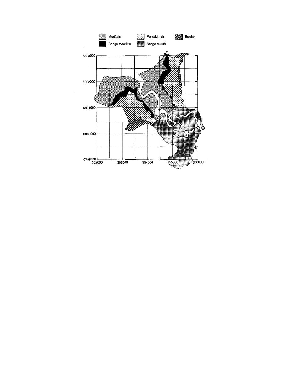
Figure 3. Distribution of primary landformvegetation units
(from Racine et al. 1993).
are transported into intertidal wetlands during
Eagle River drains a 497-km2 basin in the Chu-
tidal flooding. The Eagle River also transports
gach Mountains, 13% of which is covered by gla-
glacially derived suspended sediment during the
ciers. Average discharge was about 14.7 m3/s
melt season. The quantity of suspended sediment
from 1966 to 1981 (USGS 1981). Because of the Ea-
entering ERF in transport by river and tidal wa-
gle River's glacial origin, its maximum and peak
ters is, however, unmeasured.
discharges take place during the primary melt
As with other estuarine salt marshes in Cook
season of July and August, with peak discharges
Inlet (e.g., Hanson 1951, Vince and Snow 1984,
exceeding 100 m3/s when there are rainfall-
Rosenberg 1986), vegetation grows in zones that
induced floods during high melt periods.
are commonly determined by elevation and
The Eagle River cuts approximately through
related to the landforms of ERF (Fig. 3). This
the middle of ERF. The area primarily drains lat-
relationship is believed to be a function of flood-
erally from ponds and marshes through veg-
etated channels and unvegetated gullies into the
tion rates. Levees, mudflats, marshes and shal-
river channel (Fig. 2). About 20% of ERF is
low ponds (to 50-cm depth) are arranged in a pat-
drained along the coast by gullies that discharge
tern that approximately parallels the Eagle River
directly into Knik Arm. Its north and south boun-
and coastline (Racine et al. 1992a). Freshwater
daries are defined by uplands composed of gla-
ponds or shrub bogs lie along the upland border-
cial deposits covered by spruce and birch forests.
ing ERF.
Sediments within both the Eagle River and the
tidal waters of Knik Arm and Cook Inlet enter
ERF, and both sources are derived mainly from
PREVIOUS STUDIES
glacier runoff. Massive quantities of silt- and
The fundamental sedimentary and hydrologi-
clay-size particles are suspended within the nu-
cal processes of subarctic and arctic tidal flats
merous large rivers draining into the Inlet from
and salt marshes are not well understood; few
glacierized basins in the Alaska Range, Chugach
quantitative analyses of these processes and the
Mountains and Kenai Peninsula. These materials
factors controlling their activity have been made.
can remain suspended for extended periods and
3


 Previous Page
