EM 1110-2-2907
1 October 2003
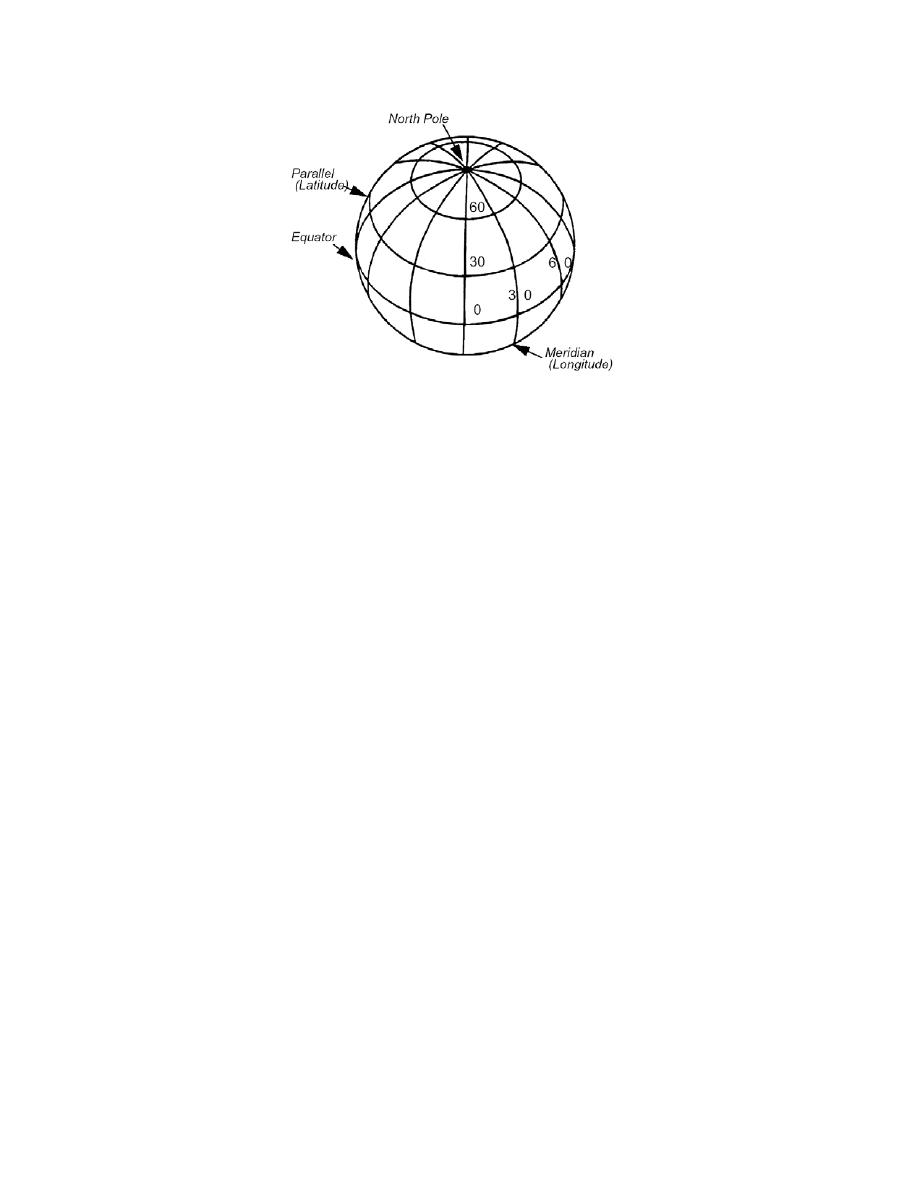
Figure 5-2. Geographic projection.
5-10 Longitude. The lines of longitude pass through the poles, originating at Green-
wich, England (0o longitude) and terminating in the Pacific (180o). Because the Earth's
spherodal shape approximates a circle, its degree measurement can be given as 360o.
Therefore, to travel half way around the world one must move 180o. The degrees of lon-
gitude increase to the east and west, away from the origin. The coordinate value for lon-
gitude is given by the degree number and the direction from the origin, i.e., 80oW or
130oE. Note: 180oW and 180oE share the same line of longitude.
5-11 Latitude/Longitude Computer Entry. Software cannot interpret the
north/south or east/west terms used in any coordinate system. Negative numbers must be
used when designating latitude coordinates south of the Equator or longitude values west
of Greenwich. This means that for any location in North America the latitude coordinate
will be positive and the longitude coordinate will be given as a negative number. Coor-
dinates north of the equator and east of Greenwich will be positive. It is usually not nec-
essary to add the positive sign (+) as the default values in most software are positive
values would be recorded as decimal degrees in the computer as 43.1o, 79.95 o. Notice
that the negative sign replaces the "W" and minutes were converted to decimal degrees
(see example problem below). Important Note: Coordinates west of Greenwich Eng-
land are entered into the computer as a negative value.
5-12 Transferring Latitude/Longitude to a Map. Satellite images and aerial
photographs have inherent distortions owing to the projection of the Earth's three-di-
mensional surface onto two-dimensional plane (paper or computer monitor). When the
Latitude/Longitude coordinate system is projected onto a paper plane, there are tremen-
dous distortions. These distortions lead to problems with area, scale, distance, and direc-
tion. To alleviate this problem cartographers have developed alternative map projec-
tions.
5-4


 Previous Page
