EM 1110-2-2907
1 October 2003
(go to http://geology.usgs.gov/tools/metadata/standard/metadata.html). The importance
of metadata cannot be overemphasized.
5-4 Viewing the Image. Image files are typically displayed as either a gray scale or
a color composite (see Chapter 2). When loading a gray scale image, the user must
choose one band for display. Color composites allow three bands of wavelengths to be
displayed at one time. Depending on the software, users may be able to set a default
band/color composite or designate the band/color combination during image loading.
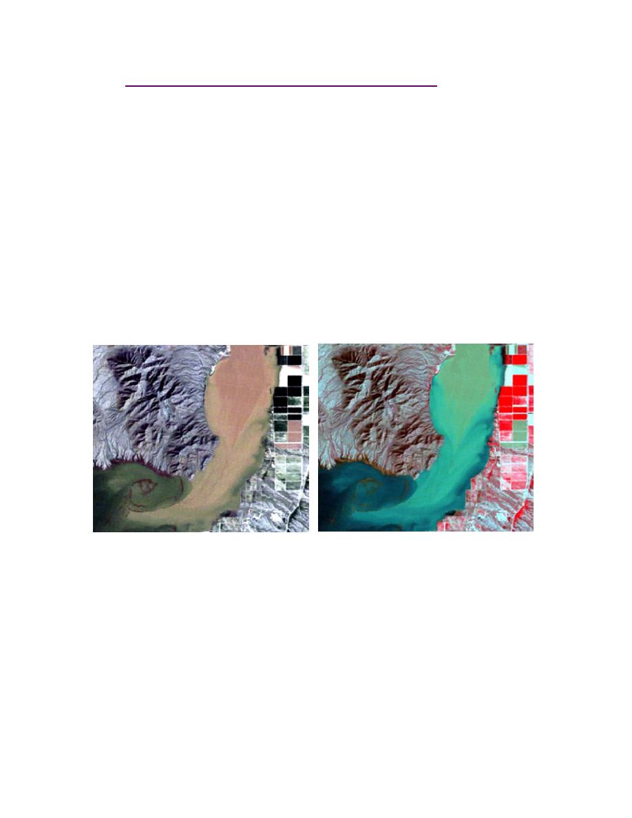
5-5 Band/Color Composite. A useful initial composite (as seen in Figure 5-1a) for
a Landsat TM image is Bands 3, 2, 1 (RGB). This will place band 3 in the red plane,
band 2 in the green plane, and band 1 in the blue plane. The resultant image is termed a
true-color composite and it will resemble the colors one would observe in a color photo-
graph. Another useful composite is Bands 4, 3, 2 (R, G, B), known as a false-color com-
posite (Figure 5-1b). Similar to a false-color infrared photograph, this composite dis-
plays features with color and contrast that differ from those observed in nature. For
instance, healthy vegetation will be highlighted by band 4 and will therefore appear red.
Water and roads may appear nearly black.
a. True-color Landsat TM composite 3, 2, 1
b. False color composite 4, 3, 2.
(RGB respectively).
Figure 5-1. Figure 5-1a is scene in which water, sediment, and land surfaces appear
bright. Figure 5-1b is a composite that highlights healthy vegetation (shown in red); water
with little sediment appears black. Images developed for USACE Prospect #196 (2002).
5-6 Information About the Image. Once the image is displayed it is a good idea to
become familiar with the characteristics of the data file. This information may be found
in a separate metadata file or as a header file embedded with the image file. Be sure to
note the pixel size, the sensor type, data, the projection, and the datum.
5-7 Datum.
a. A geographic datum is a spherical or ellipsoidal model used to reference a coordi-
nate system. Datums approximate the shape and topography of the Earth. Numerous
5-2


 Previous Page
