RIVER ICE INFLUENCES ON FORT PECK REACH, MISSOURI RIVER
83
location of thinner ice in January, it is likely that the greater thickening is attrib-
utable to under-cover accumulation of broken or frazil ice conveyed to the site.
The frazil ice may have formed in open water areas upstream.
At several places along the bank between cross sections in the site, the ice
cover was relatively thin, sometimes only a few inches thick where the ice cover
had refrozen after sections of collapsed bank had broken through it.
The last image from the web camera on March 16 shows that the ice cover
was intact but that water was beginning to ooze over the ice cover. The following
morning the ice was gone (Fig. 57a).
Bed profiles
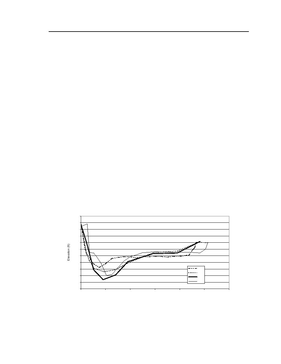
The bed profiles reveal that the bed lowered substantially along the thalweg
when the site was ice-covered. The thalweg dropped about 56 ft in elevation
between the October and the winter surveys, as is shown in Figure 59 for the
cross section at RM 1623.97. Except for the downstream cross section (RM
1623.97), the bed elevation along the river's thalweg did not recover significantly
after the ice cover broke up. The thalweg remained entrenched at those cross
sections because of the downstream migration in the apex of the loop in the river.
The migration would alter the approach alignment of the thalweg so that the flow
continued to maintain the lowered bed level. At the downstream cross section,
the thalweg bed elevation recovered almost to the prewinter elevation, but the
thalweg widened. The recovery is likely attributable to the recent collapse of the
1915
1910
1905
1900
1895
1890
1885
1880
Oct
1875
Jan
1870
Feb
April
1865
1860
0
100
200
300
400
500
600
Distance Relative to Downstream Left Bank (ft)
Figure 59. Bed profile cross sections at RM 1623.97.


 Previous Page
