potential contamination based on the results from
and greater river discharge associated with a glacial
Washington Impact Area, comparisons of the use of the
surge of the Black Rapids Glacier during the 1930s.
different areas based on the range records, and the
Soils of the terrace consist of alluvial silty, sandy gravel
differences or similarities in environmental conditions.
with cobble clasts up to 10 cm. There is a sporadic thin
veneer of loess (wind-blown silt) in localized areas of
Environmental setting
the terrace. Also, within former channel swales there
Fort Greely covers about 267,000 ha (661,341 acres)
are deposits of silty sands of variable thickness.
near Delta Junction in Central or Interior Alaska. The
According to Jorgenson et al. (2001) permafrost is
area is located in the southeast corner of the Tanana-
absent on these gravel bars due to groundwater activity
Kukodwim Lowlands Physiographic province
but there are questions concerning the presence or
(Wahrhaftig 1965) just north of and bordering the
absence of permafrost here.
Alaska Range province. Elevations range from 400 to
The mean annual temperature at Fort Greely is
2.77C. Important features of the environment at Fort
1800 m, and because of its location just north of the
Alaska range it has been glaciated and includes features
Greely include strong winds, especially in the winter,
such as glacial moraines, glaciofluvial sediments, and
which often sweep across the gravel bars and floodplain
loess (Pw and Holmes 1964, Church et al. 1965).
of the Delta River and move and deposit loess in the
The Washington Range occupies about 1650 ha
summer. Snow cover during the winter is most likely
(4125 acres) along the Delta River (Fig. 1) and is located
sparse due to the strong southerly winds that sweep
on the Mount Hayes D-4 Quad-SW. The study area,
down the Delta River (Benson 1972).
about one-half of the Washington Range or 800 ha (2000
As floodplain terraces build up and are no longer
acres), is located on a terrace elevated several meters
flooded, vegetation develops according to a
above the active channel of the Delta River. The Delta
successional sequence. This sequence is fairly well
River is a broad, gravel-braided glacial outwash system
known for the Tanana River (Viereck et al. 1993) but is
west of the main cantonment area of Fort Greely that
clearly different on the Delta River where the substrate
flows from the Alaska Range northward to the Tanana
contains more gravel rather than the alluvial silts
River (Dingman et al. 1971). The terrace was most likely
dominant on the Tanana River floodplains (Pw and
formed during a more active period of sedimentation
Reger 1983). The succession on these gravelly
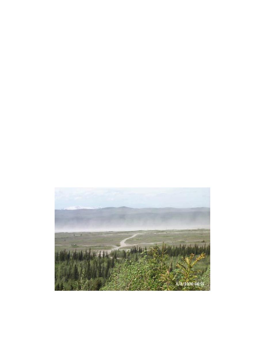
a. View from Observation Point 10, Fort Greely, Alaska.
Figure 1. Washington Impact Area.
2


 Previous Page
