Cazenovia Creek, New York
Cazenovia Creek at West Seneca is no stranger to ice jam flooding.
The first recorded ice jam at West Seneca in ERDC-CRREL's Ice Jam
database is dated February 1904. In March 1955, damages of 7K
(1955 USD) were reported when flooding occurred after 2.4 inches of
rain fell in six hours over frozen ground. Gage records say all stages
were affected by ice jams.
In March 1956, 2.1 inches of rain fell, resulting in discharge of
about 13,000 cubic feet per second at the Ebenezer gage; flooding
damages were K (1956 USD). In January 1959, rainfall on the 20th
and 21st fell on nine-inch snowpack, combined with warm
temperatures, and caused heavy runoff. The January 1959 event
resulted in higher water levels (even though lower discharge) than
March 1955 or March 1956. Levees were built as a result of this flood.
The resulting cost was 86K in damages (1959 USD) (Buffalo District
1966).
Levees built after the January 1959 event prevented about 5K
in damages during a breakup jam that occurred in January 1962. In the
1960s, blasting was used to relieve flooding caused by ice jams in the
upper reaches of Cazenovia Creek (Buffalo District 1966, Rock Island
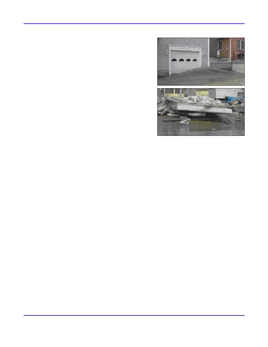
Figure 5. An ice jam in March on the Cat-
District 1967).
taraugus Creek at Sunset Bay, New York, left
In February 1970, flooding resulted in damages of K (1970
behind mud piles (top) and ice debris (bottom).
USD). The Buffalo District Situation Report (1972) referred to a 1.5-
Photos courtesy of Larry Sherman, CELRB.
mile-long jam that caused flooding on 2829 January, with preliminary
damage estimates of K, followed by receding waters. The jam stayed in place, however, and caused additional flooding
on 23 February. One hundred people were evacuated; flooding peaked at 0100 hours and had receded one foot by 0800
hours. At the time, damages were estimated about equal to the January 1959 event (Buffalo District 1975).
Cazenovia Creek continues to experience ice jam flooding to this day. On 16 March 2003, ice broke up rapidly on the
upper reaches of Cazenovia Creek (Fig. 6). A large ice flow moved downstream from West Seneca, New York (NWS 2003g)
(Fig. 7). That night some Willowdale residents were evacuated from their homes (Gustek and Koralewski 2003). On 17
March, officials reported three ice jams in place along Cazenovia Creek. The ice cover had settled down and jammed on the
creek from the Buffalo River through the City of Buffalo flood control project to Cazenovia Road. Another jam extended
from about 2000 feet upstream of Mill Road to just past Transit Road. However, this jam failed, moving downstream to jam
at yet a third jam located between the railroad bridge downstream of Ridge Road and the soccer fields downstream of
Parkside Drive. The resulting water level was high enough for water to pour over part of the levee surrounding the Parkside
Drive area of West Seneca.
On 18 March, high water from the previous night flowed over the levee on Parkside Drive (Gustek and Koralewski
2003). Evidence of the high water that flowed over the levee was visible in the mud on Parkside Drive, pumps pumping
water out of basements, sandbags around some houses, and mud over the levee where the water overtopped it (Sherman and
Koralewski 2003).
On 19 March 2003, the Town of West Seneca reported that Cazenovia Creek was now ice-free as far as the Buffalo
River.
St. John and Aroostook Rivers, Maine
Most of the ice events in Maine occurred during four time periods: 17 December, 2430 March, and 5 and 20 April.
Events during December and April occurred on the St. John and Aroostook Rivers, while the March events were scattered on
several different rivers. The jams reported in December were freezeup jams and those reported in April were breakup jams, as
expected.
ERDC/CRREL TN-04-5
5


 Previous Page
