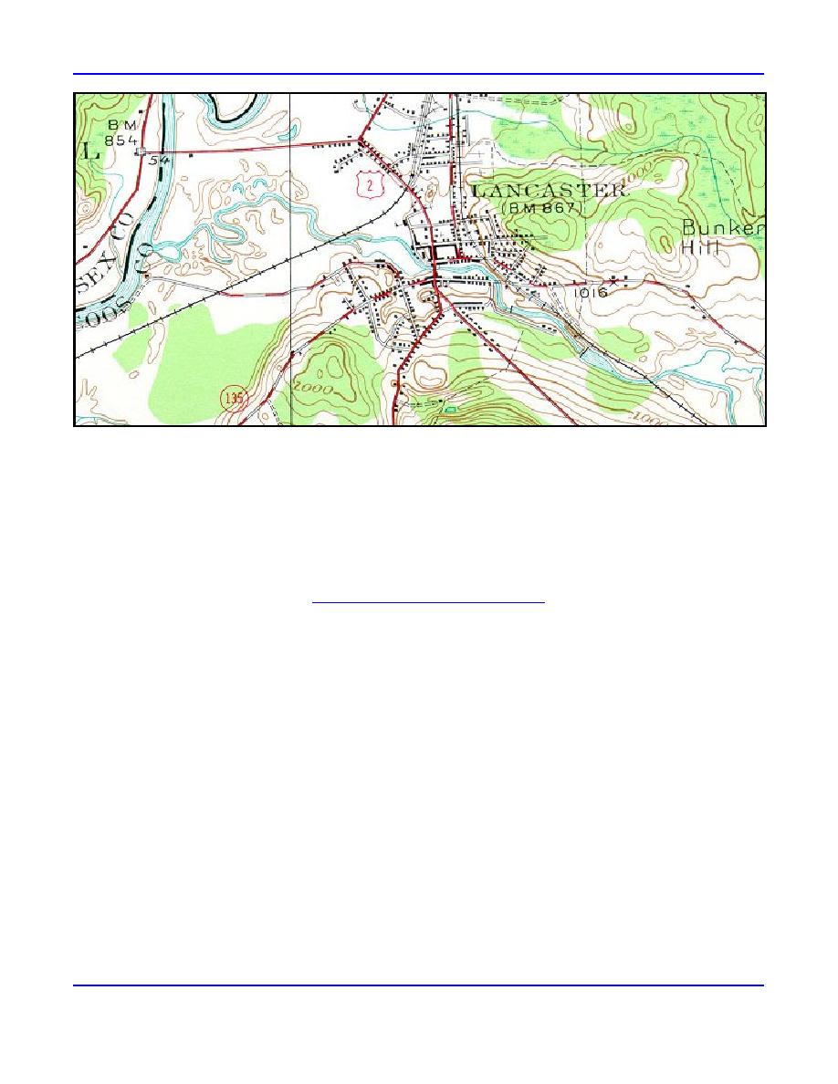
Figure 3. Contour map of Lancaster, New Hampshire (USGS 1935.) Two former dams and their impoundments are shown.
The other two former dams were located just upstream and downstream of the Main Street (Route 2) Bridge. Damaging ice
jams now form at the upstream end of the backwater from the Connecticut River, near the railroad crossing.
Between 1936 and 1950, these dams were damaged during large flood events, eventually leaving only ruins after 1950.
Ice jam flooding has increased in frequency and severity since the failure and removal of the dams. Of the seven large floods
reported in Lancaster between 1870 and 1940, only two (1886 and 1895) were reported as being caused by an ice jam, but 15
of the 18 floods between 1940 and 1970 were due to ice jams (USACE 1973). An additional 14 ice jams events since 1970
are listed in the CRREL Ice Jam Database (http://www.crrel.usace.army.mil/ierd/ijdb/).
Following the disappearance of the dams, frazil ice that formerly accumulated in the dam impoundments was able to
move downstream and accumulate in the reach of river affected by backwater from the Connecticut River, beginning in the
area near the railroad bridge abutments (Fig. 3). Frazil ice deposits seven to ten feet thick have been measured at this
location. This thick ice cover, combined with a reduction in energy gradient associated with backwater from the Connecticut
River, provides a jam initiation point during ice cover breakup. With the dams no longer in place to delay movement of
broken ice, ice transport is unimpeded and a relatively large volume of ice is able to move downstream. When this moving
ice reaches the thicker ice in the backwater area, jams can initiate and progress upstream, often causing flooding of the town.
These breakup ice jam flood problems have recently been compounded by the formation of freezeup jams, beginning in
1997. These jams tend to form early in the season and result in higher-than-normal water levels throughout the winter. The
high water levels cause infiltration to the sewer lines, thereby increasing operation and maintenance costs. Bank erosion near
the toe of the freezeup jam threatens a drop structure that carries sewage under the river to the pump station.
The freezeup jams also have the potential to cause increased flooding during ice cover breakup later in the season. This
breakup flooding occurs much more suddenly than a typical breakup jam, leaving virtually no time for emergency response.
Over the last decade, Lancaster has flooded as a result of ice jams (Fig. 2) approximately five times without warning.
Following a devastating ice jam flood in 1968 (M in damages in 1968 dollars), the Corps of Engineers' New England
Division (now District, NAE) and CRREL performed a detailed Section 205 study that resulted in the construction of an ice
control structure (completed in 1981) at the approximate location of the third dam. The structure was originally designed to
halt the movement of upstream ice, thus limiting the ice volume available to jam in town. However, economic and
environmental constraints limited the size and scope of the project, which was constructed as a 160-ft-long, 9-ft-high,
concrete-capped gabion weir with four sluiceways intended to assist fish passage.
ERDC/CRREL TN-03-2
3


 Previous Page
