Table 1. System configurations.
Land-line
No land-line
Land-line
No land-line power or standard phone service
power and
power,
power,
Cellular
Wireless
Satellite
standard
standard
no standard
phone service phone service phone service telephone
RF
Ethernet
transceiver
Pressure
Pressure
Pressure
Pressure
Pressure
Pressure
Pressure
transducer
transducer
transducer
transducer
transducer transducer
transducer
Data
Data
Data
Data
Data
Data
Data
acquisition
acquisition
acquisition
acquisition acquisition acquisition
acquisition
device
device
device
device
device
device
device
Notification
Notification
Notification Notification
Radio
Wireless
Satellite
device
device
device
device
telemetry
Ethernet
transceiver
Data transfer Data transfer Data transfer Data transfer
modem
modem
modem
modem
Battery
Cellular
backup
Battery
telephone
Battery
Battery
Battery
Battery
Charge
Battery
Charge
Charge
Charge
Charge
controller
backup
controller
controller
controller
controller
Solar panel
Solar panel Solar panel Solar panel
Solar panel
Demonstration
Lancaster, New Hampshire, lo-
cated on the Israel River, is prone to
flooding caused by unpredictable ice
jams (Fig. 2). The Israel River is
appproximately 21 miles long and has
a drainage area of about 136 square
miles at its confluence with the
Connecticut River in Lancaster. The
river is generally shallow and relative-
ly steep, with a rough bed, until it
reaches the mildly sloping reach about
1.5 miles long that results from the
backwater of the Connecticut River.
The Israel River produces a tremen-
dous amount of frazil ice during early
winter, forming substantial deposits in
the backwater reach of the Connec-
ticut River.
As with many New England
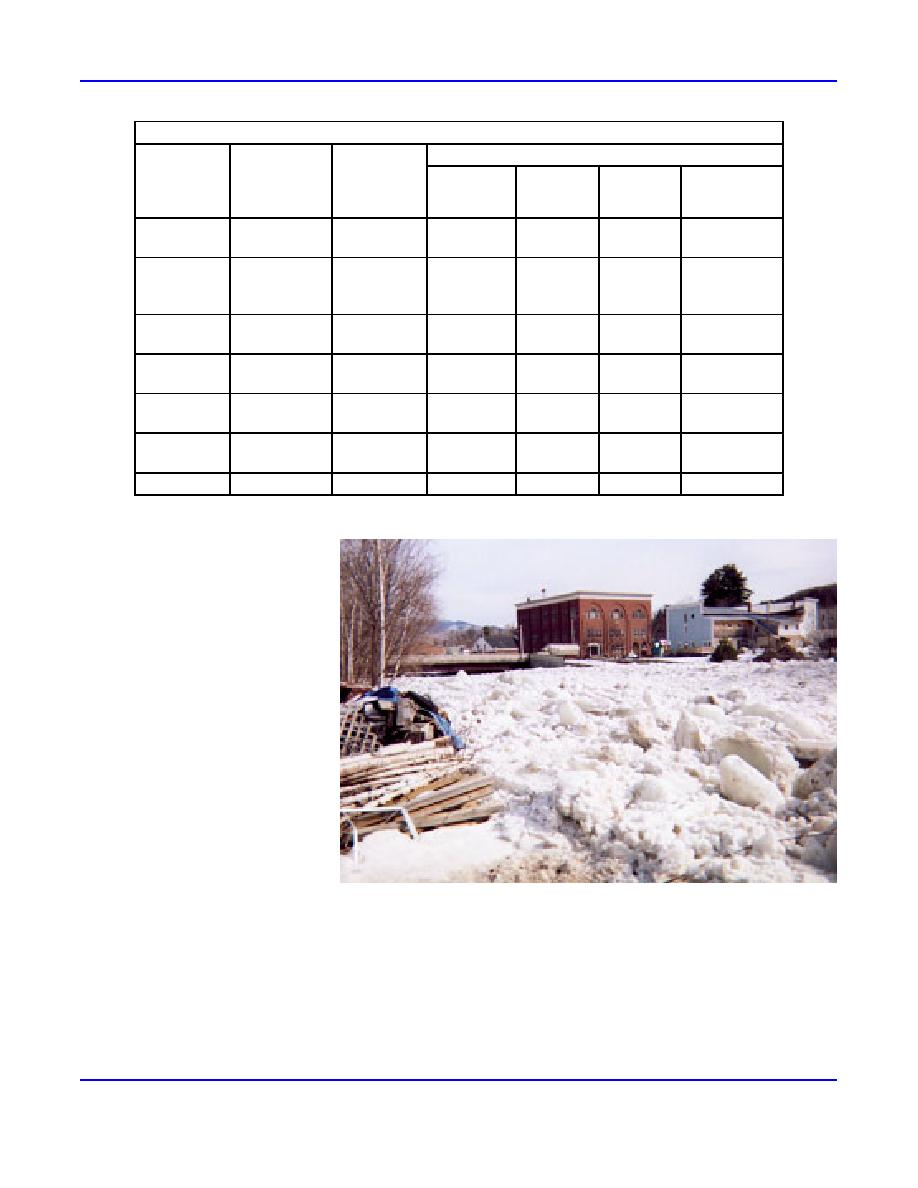
Figure 2. Ice jam, 6 February 1996. This jam resulted in flooding, property
towns, settlement along the river was
damage, and street closings in Lancaster, New Hampshire.
accompanied by the construction of
dams to supply mechanical power. A New Hampshire Water Resources Board dam inventory in 1936 reported four dams
within Lancaster. These included a 20-ft-tall timber crib dam located just downstream from the Main Street Bridge and a
second 20-ft-high dam upstream from the bridge. The locations of the third 20-ft-high 220-ft-long dam, and the fourth dam,
25 feet high, can be seen in Figure 3. Each dam created a small impoundment that captured frazil ice during the winter and
slowed the movement of ice downstream during breakup. The delays in ice movement caused by the dams decreased the
volume of ice available to jam in and near the center of town.
2
ERDC/CRREL TN-03-2


 Previous Page
