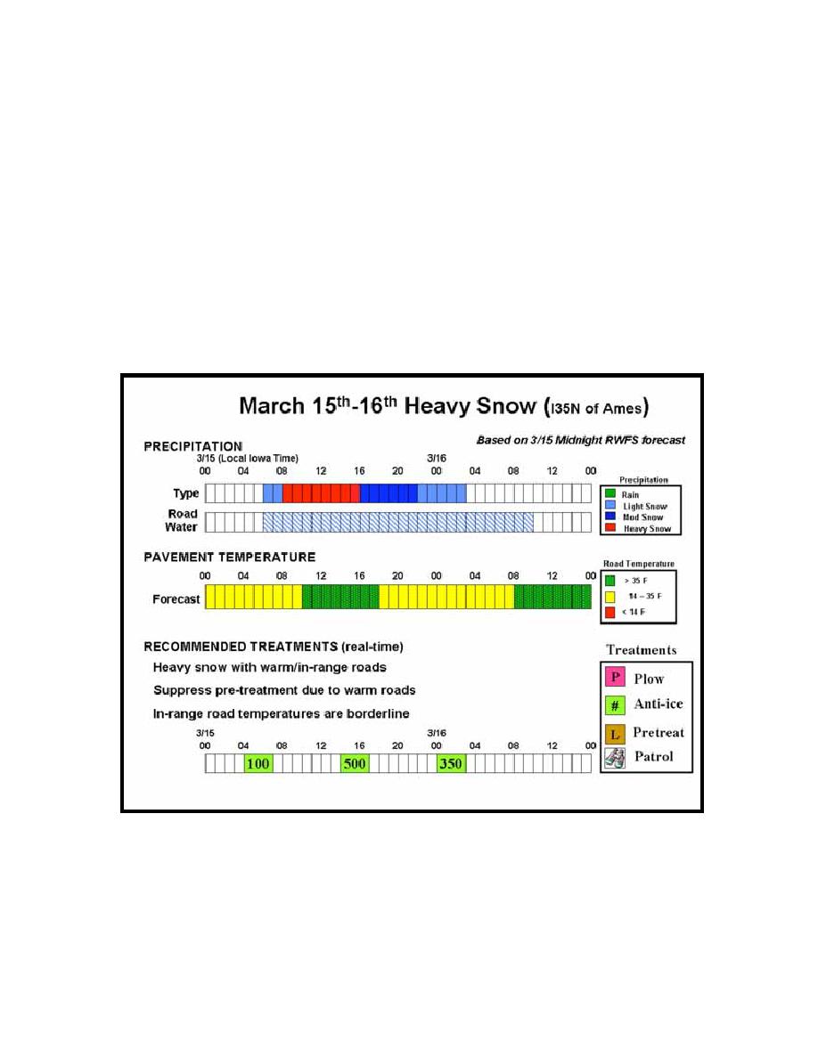
11.3.2 Verification report for March 15-16, 2004 storm
snow in the Ames area and lasting approximately 21 hours. Fig. 11.18 shows the RWFS
forecasted conditions and RCTM recommended treatment actions for this storm as shown
for the March 14th midnight (local time) forecast. The selected route is the I35N route
serviced by the Ames garage. Light snow was predicted to begin at 0600 (6AM), and
quickly ramp up to moderate and heavy snow over the next 10-15 hours before trailing
off at around 0300 on March 16th. The road water timeline is used to show that the road is
forecasted to remain wet even after the precipitation stops. In this case, the road isn't
expected to dry out until after 1000 on the 16th. Road temperatures were forecasted to
start in-range (14-35 F) but temperatures were borderline during most of the storm and, in
fact, were forecasted to warm up above 35 F during some of the most intense portions of
the storm.
Fig. 11.18. March 15-16 forecast and treatment recommendation timeline.
The RCTM characterized the storm as a heavy snowstorm with warm/in-range road
temperatures. The system suppressed pre-treatment because the road surface was
predicted to be warm during the storm. An initial treatment of 100 lbs/lane-mile is
recommended at the start of the storm. A follow-on treatment of 500 lbs/lane-mile isn't
recommended until 1400 (2PM on the 15th) just before the road temperature is predicted
118


 Previous Page
