tion of cloud type), allowing for larger liquid-water
contents in shorter distances, Appendix C represents
only integrated liquid-water contents over distances and
does not address maxima or minima that can occur
within those distances. That is, "pockets" of liquid-water
content can be much larger or smaller than the inte-
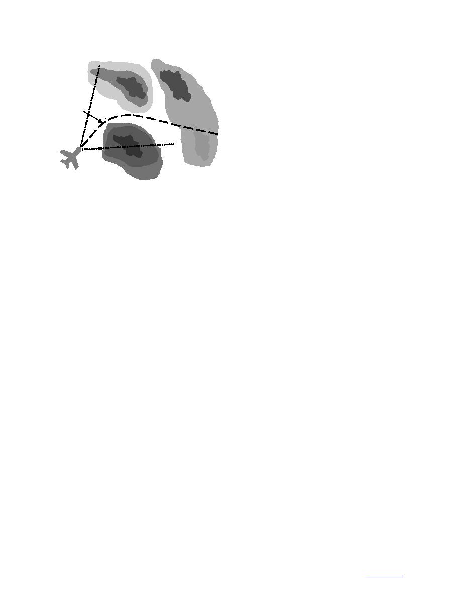
Proposed
grated values within a distance represented by Appen-
Flight
Path
dix C. According to Masters (1983), the original intent
of Appendix C was to represent averaged liquid-water
content values during exposure over varying distances,
so Appendix C is only a starting point for remote-
sensing system specification. Appendix C is effective,
within its limits, for creating ice-protection system
Sensor-Equipped
specifications as long as instantaneous values of liquid
Aircraft
water are of no concern, but it is not as effective for
Figure 2. Sensing range affects avoid-and-exit capability.
determining the maximum and minimum liquid-water
values that may be experienced along a given route of
flight. For this reason, it is necessary to review field
may provide indications of the range and spatial reso-
measurements within icing conditions to determine the
lution needed by remote-sensing systems. The ability
absolute range of conditions that can be experienced.
of a system to sense completely through typical icing
In addition, the range of conditions with greatest impact
storm areas, for example, would provide aircraft with
on aircraft operations must be considered for studies of
avoidance capability without the risk of entrapment
the effect of icing on in-flight aircraft performance (Jeck
(Kirkpatrick 1970) (Fig. 2). In addition, if icing poten-
1998).
tial is nearly uniform spatially at the submesoscale, then
The National Advisory Committee for Aeronautics
remote-sensing capabilities may not be practical for
(NACA) Lewis Flight Propulsion Laboratory and Ames
avoiding or escaping icing. Spatial characteristics at the
Aeronautical Laboratory conducted many research
synoptic scale will indicate what portions of storms
flights within stratus and cumulus clouds from 1945
provide the greatest icing threat and indicate where
through 1950 (Lewis et al. 1947, Lewis and Hoecker
remote-sensing systems are most needed. Global-scale
1948, Kline 1949, Kline and Walker 1951). Cloud
patterns of icing indicate where icing threats and the
liquid-water content was measured with rotating multi-
needs for remote-sensing capabilities are greatest.
cylinders and a rotating-disk icing-rate meter. Rotating-
multicylinder and icing-disk measurements are inte-
4.3 Characterization needs
grated over periods of minutes, so absolute magnitudes
Characterization of the dynamic range of liquid
over shorter periods, and thus distances, are not well
water, drop size, and temperature are needed to estab-
identified. Nevertheless, one flight program provided
lish sensing specifications for hardware development.
maximum liquid-water contents of 0.28 g m3 and 0.76
The general ranges of conditions that could be observed
are generally understood (Pruppacher and Klett 1997,
90% of the measurements measured less than 0.5 g m3
Rogers and Yau 1989, Fletcher 1962), but the absolute
in stratus clouds and less than 1.2 g m3 in cumulus
ranges of conditions within icing clouds, and the ranges
clouds (Lewis et al. 1947). Flights over the Great Lakes
of conditions necessary to produce dangerous ice accre-
measured liquid-water contents ranging from 0.05 g m3
tions on aircraft under a full range of flight and design
to 0.57 g m3 with a median of 0.22 g m3 and a mean of
conditions, are not well known.
0.19 g m3 (Kline 1949). Ninety percent of liquid-water
contents were less than 0.40 g m3, and 50% of all cases
4.3.1 Liquid-water content
were less than 0.18 g m3. Thirty-seven research flights
FAR 25, Appendix C (FAA 1991), defines liquid-
water content and mean effective drop diameter (similar
over most of the northern United States measured mean
to the median volume diameter [MVD]) from the sur-
values of maximum liquid-water contents averaged over
face to 6707 m for stratiform clouds and from 1220 m
distances of 0.5, 3.0, 15, and 60 miles of 1.05, 0.63,
to 6707 m for cumuliform clouds. This is the minimum
0.16, and 0.08 g m3 for stratus clouds. Finally, flights
standard to which all aircraft ice protection is designed
and may be the minimum standard to which remote-
in stratiform clouds yielded a maximum liquid-water
content of 1.30 g m3, with 90% of measurements less
sensing systems should be designed. However, although
than 0.54 g m3 and 50% less than 0.30 g m3 (Kline
horizontal extent is factored into Appendix C (as a func-
14
To Contents


 Previous Page
