20
ERDC TR-05-1
The next step was to geographically register each mosaic to real earth coor-
dinates. Commercial image processing software (ERDAS Imagine) geo-regis-
tered each individual mosaic to one of two digital base images. The primary
source used as digital base maps were high resolution U.S. Geological Survey
(USGS) Digital Orthophoto Quarter Quadrangles (DOQQ). The Root Mean
Square Errors (RMSE), or registration accuracies, of the small mosaics covering
the wetland Knapps Narrows, for example, were less than one pixel (< 0.87 m).
The RMSE for the much larger Hell Hook mosaic was roughly nine pixels (~7.83
m). Registration accuracy is critical to the overall quality of the final map
products. With good positional accuracies of the mosaics, the digital outputs can
be co-registered with other data sets, including any available field data, and util-
ized in subsequent reference wetland investigations.
DOQQs were not available for Piney Creek. Therefore, medium resolution
digital 7.5' topographic quadrangles served as base imagery for geo-registering
this site. Owing to the decreased level of detail seen in the digital topo quads
(e.g., generalized shore lines, generalized road locations), the registration accu-
racies of the Piney Creek mosaics were much poorer. RMSEs were closer to 10
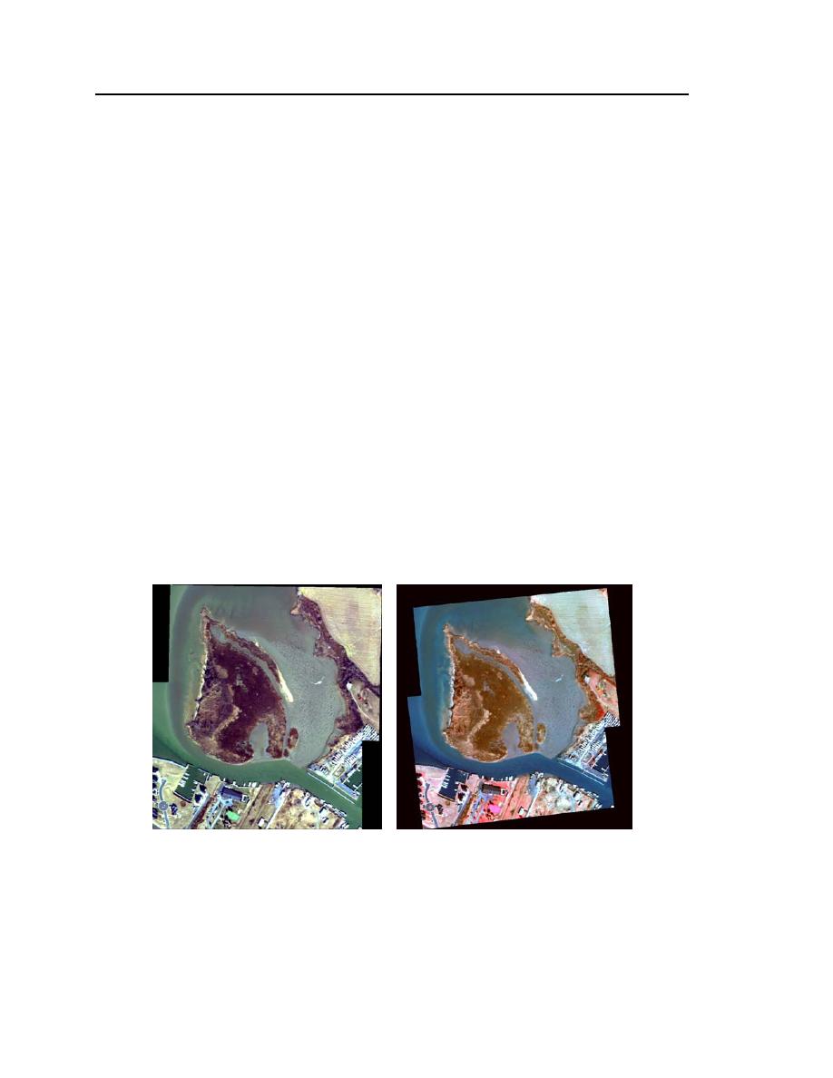
pixels. Figure 11 shows the relatively minor spatial displacement of the Knapps
Narrows mosaic after geo-registration to a DOQQ. Figure 12 shows the signifi-
cant warping of the Piney Creek mosaic after registration to the digital topog-
raphic quadrangle.
Figure 11. Knapps Narrows mosaic before and after geometric registration
to DOQQ. The non-registered mosaic (left) is depicted using true-color
(bands 3, 2, and 1); the geo-registered mosaic (right) is depicted using
false-color (bands 4, 3, and 2).


 Previous Page
