samples were also collected 3.0 m perpendicular, on
metallic debris found in the crater, the presence or ab-
both sides, to the direction of fire at distances of 5.0 m
sence of ash, and the degree of weathering that had
and 10.0 m. The final soil sampling took place two
occurred around the rim of the crater. Soil from the
meters in front of the muzzle where a wheel-shaped
impact area was characterized and results are present-
1.2-m-diameter sheet of plastic was placed on the
ed in Table 2. Vegetation in the area sampled consisted
ground and a set of seven samples was collected in a
mainly of grasses and various low shrubs and a few
wheel pattern in a manner similar to that described for
widely scattered small evergreen trees. Samples were
the hand grenade range. Also, two depth samples, 05
collected throughout this area around various points of
cm and 59 cm, were collected in the center of the circle.
interest. EOD personal were invaluable at determining
This sampling scheme produced a total of 22 surface
the specific type of munition that caused particular cra-
and two different depth soil samples at Howitzer #1
ters, as well as estimating the age of these craters. The
(Fig. 3).
most recent craters were produced the day before sam-
pling from the impact of 105-mm howitzer rounds. Also
considered recent (within the last month) were several
Howitzer #2
mortar craters from various size rounds. Also, several
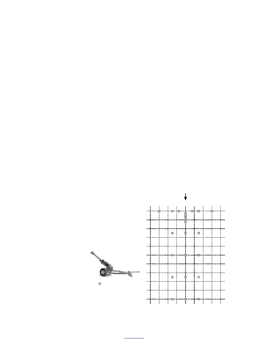
A measuring tape was placed on the ground in front
older craters were sampled that appeared to vary in age
of Howitzer #2 in the direction of fire. Using a putty
from months to years, and which were produced by
knife, surface soil samples were collected along the
various size artillery and mortar impacts.
measuring tape at the following distances from the
The sampling of craters generally consisted of col-
muzzle: 0.5, 1.0, 1.5, 2.0, 2.5, 5.0, 10.0, 15.0, and 20.0
lecting surface soil randomly spaced around the rim of
m. Surface soil samples were also collected on both
the crater, around the inside sloping surface of the crater,
sides perpendicular to the muzzle of the gun at distanc-
and at the bottom of the crater. With the assistance of
es of 1.5, 3.0, and 6.0 m. Surface soil samples were
the EOD team, several soil samples were collected
also collected on both sides 3.0 m perpendicular to the
around and below a 155-mm artillery low-order deton-
direction of fire at distances of 5.0, 10.0, 15.0, and 20.0
ation round, and three surface soil samples were col-
m from the muzzle. This sampling scheme produced a
lected around a low-order 120-mm mortar round. Sev-
total of 23 soil samples at Howitzer #2 (Fig. 4).
eral samples and the associated surface organic matter
Artillery range impact area
were collected in areas that were overgrown with veg-
etation and had no apparent disturbance within several
The artillery impact area (91st Division Prairie) at
meters. Numerous surface soil samples and some depth
Fort Lewis consists of approximately 3800 hectares.
The portion of the impact range chosen for sampling
Gun Orientation
was approximately 1 km in diameter and was centered
at the approximate impact point for the 105-mm how-
8
6
4
2
0
2
4
6
8m
itzers described earlier. Soil sampling was conducted
0m
on 8 July 2000. We were escorted by two EOD techni-
cians from the 707th Ordnance Disposal Company at
2
Fort Lewis who assisted us, not only in matters of safety,
but in providing their opinion on the type of round that
4
had created specific craters, as well as estimating the
6
age of each. They made these judgements based on the
8
10
12
14
16
Samples Collected
18
Gun #2
105-mm Howitzer
20
Figure 4. Surface soil samples collected at firing point in front of the muz-
zle of 105-mm Howitzer #2.
6
To contents


 Previous Page
