60
260
Upstream Edge
of Freezeup Jam
40
250
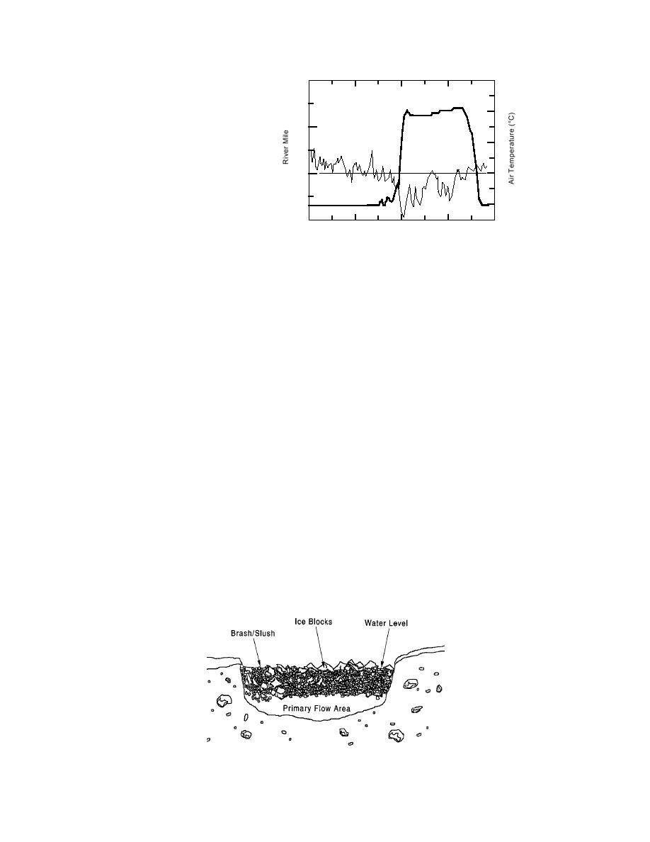
Figure 8. Temporal variation of
Daily Mean
20
Air Temperature
air temperature and location of
upstream edge of a freezeup jam
0
240
on the Salmon River, Idaho,
199091.
20
230
0
40
80
120
160
Julian Day (1 Oct = 1)
Factor of the Hudson's Bay Co. post at Fort McMurray in Alberta and described the
following events on the morning of 20 April 1875:
...The winter of 187475 was a bitter one, with deep snow and never a thaw until
April. On the 2nd or 3rd of that month, however, a further heavy fall of snow was
followed by a sudden rise in temperature. The change of weather and the weight of
melting snow caused the ice for the 85 mile stretch of rapids above the fort [Fort
McMurray] to breakup, and it came down the Athabasca with terrific force. On strik-
ing the turn of the stream at the post it blocked the river and drove the ice 2 miles up
the Clearwater [a major tributary] in piles 40 to 50 feet high. In less than an hour the
water rose 57 feet, flooding the whole flat and mowing down trees, some 3 ft. in diam-
eter, like grass....
As its name implies, a breakup jam consists of pieces of broken sheet ice, refro-
zen frazil ice, and brash or slush ice. Figure 9 depicts a fairly typical breakup jam.
Freeze-bonding of ice pieces is usually negligible for a breakup jam, because the
above-freezing air in which they form inhibits it. Breakup jams typically form at
reaches where the downstream progression of a run of moving ice (or breaking
front) slows because of reductions in channel slope, or width, or where it encoun-
ters resistant portions of ice cover, such as locations of freezeup accumulations.
The severity of flooding during breakup jams depends on many factors, such as
initial ice cover thickness and strength, characteristics of the runoff hydrograph,
and, relatedly, weather. Gradually warming weather with no rain, for instance,
Figure 9. Cross section of a breakup jam.
8


 Previous Page
