intervals ranging from 1- to 60 seconds around the
4
5
clock. Their system had a maximum range of 11.46
m (37.6 ft). This system has an additional advan-
tage in that, with the proper siting, it could also
2
double for measuring ice thickness (see following
section on Ice Thickness). The greatest drawback
to the use of either ultrasonic or radar systems is
1
that they measure to the first surface encountered.
In other words, when a stream is ice covered, the
distance to ice would be measured, rather than the
+
distance to true water surface. If true stage were
3
desired by use of either system, it would be nec-
essary to keep an area of open water below the
instrument.
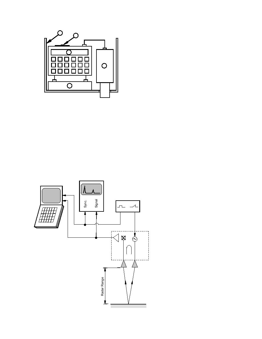
Figure 10. Section view of ultrasonic stage recorder: 1
The system described by Yankielun and Ferrick
is the ultrasonic sensor, 2 is the data logger, 3 is the
consisted of the radar front end, a function gen-
power source, 4 is the weatherproof enclosure, and 5 is
erator, a dynamic signal analyzer, and a 12-bit
the output port for downloading data to a laptop or tele-
analog-to-digital converter internal to a laptop
phone.
computer. The radar front end consists of a volt-
age controlled oscillator (VCO), waveguide com-
ponents, transmit and receive antennas, a mixer
measurement of stage with a millimeter-wave
and an audio amplifier. A schematic of the system
(MMW) frequency modulatedcontinuous wave
is shown in Figure 11. Power was provided by a
(FMCW) radar (Yankielun and Ferrick 1993). The
portable, gasoline-driven electric generator. The
system deployed by Yankielun and Ferrick could
unit could be mounted on a trailer to be hauled
be mounted from a bridge and used to acquire,
from site to site. A permanent installation would
process, store, and display river stage data at time
require AC power to the site.
Signal processing is probably the biggest ob-
HP 3660A
stacle to field implementation. If it is desired to
Dynamic Signal Analyzer
Laptop Computer
measure stage for only one event, then processing
with 12-bit A/D Card
HP 3314A
Function Generator
Figure 11. Schematic of MMW
Mixer
FMCW used for velocity de-
MMW
termination (from Yankielun
VCO
and Ferrick 1993).
Radar
Front End
Rx Antenna
Tx Antenna
River
Surface
19


 Previous Page
