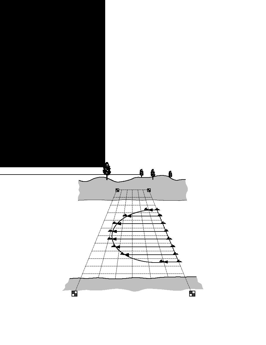
distance from the observer. Areal coverage of ice
velocities and ice concentration (Fig. 9). Prowse et
is also observed from aircraft. The extent of ice
al. also tested the use of false-parallax and image-
cover can then be documented by 35-mm camera,
digitizing photogrammatic techniques with large
video camera, or by an individual marking on a
format cameras to determine ice velocities and
map the ice cover locations. The best positioning
found them to be quite accurate for surface veloc-
for a 35-mm camera or video camera to document
ity determination, but limited in value for conver-
the ice from aircraft is straight down, as is done
sion to ice discharge estimates. Images from 35-
for aerial photographs made for mapping pur-
mm cameras were found to be adequate and much
poses. Oblique views are also very useful but do
less expensive. Prowse and Demuth (1991) used a
not readily allow for scaling of features from the
theodolite to track the movement of ice pieces to
film. The use of aircraft to view ice extent can be
measure velocity. Ferrick et al. (1991) videotaped
beneficial under favorable conditions, but suffers
markers on an ice cover before and during breakup
several drawbacks, including high cost and
to obtain information on ice velocities.
weather conditions that can ground the plane or
cause poor visibility for viewing at an adequate
Ice coverage and ice concentration
altitude. The pilot must follow a suitable flight
The areal coverage of ice and the concentration
of moving ice are two parameters that are not of-
path at the appropriate altitude to obtain complete
coverage. If film or video is used to capture ice
ten systematically monitored and, according to the
coverage, then personnel will view the film or tape
survey results, are not considered important pa-
to transfer the ice extent to a suitable map. Differ-
rameters to measure perhaps because of the diffi-
ent types of ice may be difficult to differentiate
culty in obtaining accurate information. Areal ice
from the aircraft or film records. The pros and cons
coverage may be monitored from a single vantage
of camera use are discussed further in USACE
point or series of vantage points, but the accuracy
(1990).
of observer estimation decreases with increasing
Shore
Shore
Targets
Figure 9. Photographic grid method for determining ice velocity and concentration
(after Prowse et al. 1986).
17


 Previous Page
