to indicate the onset of ice motion leading to
mounted booms, stone groins, artificial islands,
breakup of the ice cover.
timber cribs, dams and weirs.
An ice control dam obstructs the passage of ice
and can provide a reservoir to control ice until it
Structural measures
Structural control measures include the con-
eventually melts. Weirs and low-head overflow
struction of permanent or temporary structures
dams raise upstream water levels and promote
either to prevent ice-related flooding or to lessen
stable ice covers upstream. At some sites they can
damages should a flood event occur. Such mea-
also aid in controlling ice breakup in a manner
sures include means to control ice formation, re-
somewhat similar to dams. A 9-ft-high overflow
strain ice movement, and contain or divert flood
weir was built for ice control on the Israel River in
flows, either alone or in combination.
New Hampshire by the New England Division of
the Corps of Engineers (USACE 1973, 1982b). The
Flood containment
170-ft-long weir was constructed with concrete-
Flood containment normally refers to levees
capped gabions, with four, 4-ft-wide by 8-ft-deep
that physically separate the river from property
gaps to allow fish passage during the open-water
to be protected. While levees are expensive and
months. During the winter the gaps are blocked
normally limited to the protection of densely
with stop logs or metal gates to develop an ice re-
populated areas, the BufordTrenton area is cur-
tention pool (Axelson 1991). Completed in 1982,
rently protected by the levee-like irrigation ditch-
the project cost 0,000, for a unit cost of about
es. The level of protection against ice-related
00/ft.
flooding provided by this system of ditches is un-
An ice control structure consisting of a 5-ft-high
clear. The 1986 ice jam event nearly overtopped
fixed-crest weir with a Bascule gate for sediment
the ditches in both the Middle and West Bottoms.
passage was constructed on Oil Creek by the Pitts-
The maximum flow during that event was ap-
burgh District of the Corps of Engineers in 1989.
proximately 60,000 cfs, well below the two-year
The structure was 351 ft in length, including the
open-water discharge of 90,000 cfs and somewhat
45-ft-wide gate, and had a supplementary ice
less than the five-year breakup period discharge
boom located 75 ft upstream to increase its ice re-
of 67,000 cfs. Their function as flood protection
tention capability. Levees were constructed on
levees might be economically upgraded by iden-
both upstream banks to contain the Standard
Project Flood. The total project cost was .2 mil-
tifying sections vulnerable to overtopping and
lion, for a unit cost of about 00/ft.
raising them to provide a more uniform level of
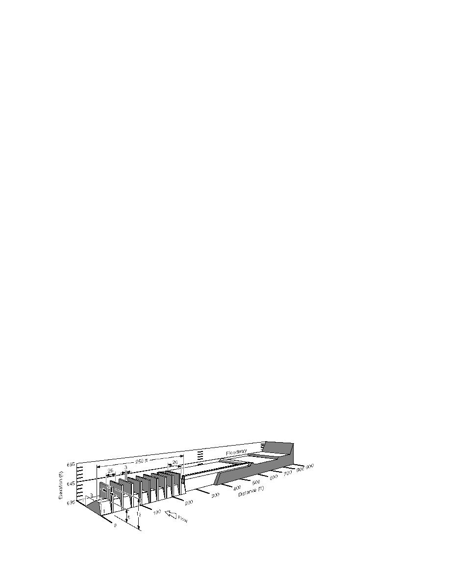
A low-head (6-ft) weir for ice breakup control
protection along the length of the system.
has been physically modeled and designed for
Cazenovia Creek near Buffalo, New York (USACE
Ice control structures
1985, Gooch and Deck 1990). As shown in Figure
Fixed structures can be used to stabilize an ice
9, the proposed weir has nine ice retention piers
cover or prevent the downstream movement of
rising above its crest and is bordered by a high-
broken ice. Stabilization of an ice cover prevents
level, bypass floodway to help limit hydraulic
premature breakup, allowing additional time for
forces that could cause the upstream ice to be ex-
the ice cover to weaken and melt in place and re-
truded through the piers. This project, designed
ducing the supply of ice for jamming down-
by the Buffalo District of the Corps of Engineers,
stream. Perham (1983) reviewed a wide variety of
has an estimated cost of million. With a struc-
ice sheet retention structures, including pier-
Figure 9. Isometric drawing of the proposed Cazenovia Creek
ice control structure. (From Gooch and Deck 1990.)
20


 Previous Page
