Surface Climate and SnowWeather Relationships of the Kuparuk Basin
31
6
DISCUSSION
The results presented here suggest that while significant differences in cli-
mate exist latitudinally and altitudinally across the Kuparuk Basin, the climate
overall is quite similar. The greatest departures from a mean annual cycle for the
Kuparuk Basin result from mesoscale factors related more to geography than to
meteorology-- the coastal proximity of BET with its seasonal maritime influence
and the foothills location of IMN with its higher elevation and susceptibility to
orographically enhanced circulations. Indeed there is even a seasonality to the
maritime influence at BET in that once the Beaufort Sea is largely ice-covered,
net heat and moisture fluxes at the oceanatmosphere boundary become quite
small and BET becomes more continental in nature.
The results presented in the previous section are the result of smoothed aver-
ages, permitting comparison of the climate states among the sites. To compare
specific meteorological events, it is instructive to consider an unsmoothed time
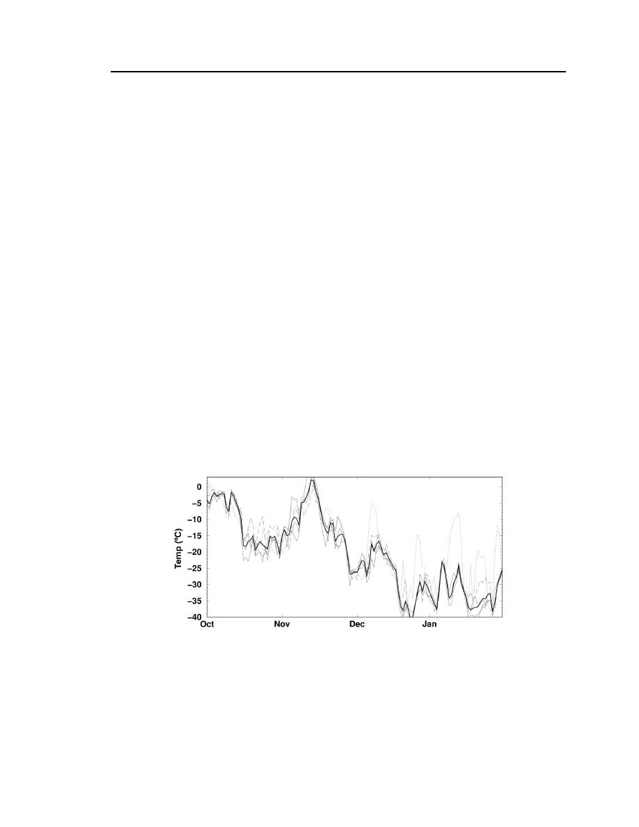
series of daily mean temperatures for a particular season. Figure 11 shows such a
plot for the period from Oct. 1997 through Jan. 1998. With the notable exception
of IMN (dotted line) from December onward, the temperature trends to first order
are generally quite similar from station to station, suggesting that the individual
synoptic events that bring substantive temperature changes in this period occur
across the entire network. The heavy curve in Figure 11 represents the average of
BET, FRA, SAG, and WKU, with IMN being excluded from the calculation due
to its quite different cold season thermal nature as discussed later.
Figure 11. Daily mean temperatures at the five sites for Oct. 1997
through Jan. 1998. The bold line represents the average temperature
of BET, FRA, SAG, and WKU; the dotted line represents the
temperature at foothills IMN; and the dashed line represents coastal
BET. No temporal smoothing was performed here.


 Previous Page
