N
Rte. 14
W
hit
VERMONT
eR
.
Rte.
4
NEW
HAMPSHIRE
White River
Junction
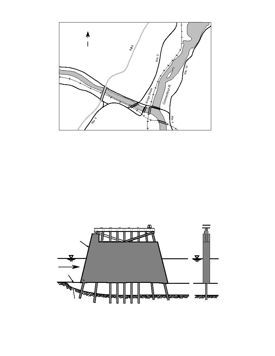
Figure 1. Location of the Bridge Street bridge, White River Junction, Vermont.
years (Fig. 4). Then why should it have failed?
portion of the piles above the mud line was en-
The most likely cause is deterioration of the struc-
cased in concrete (Fig. 2). The concrete was 2.5 ft
wide and 44 ft long at the mudline, with a 90
tural integrity of the foundation due to the cu-
mulative effect of scour. Several post-failure ob-
pointed nose.
servations indicate that scour around the Bridge
This temporary bridge lasted until January 26,
Street piers was the primary cause of failure,
1990, when it collapsed during ice breakup. One
pier collapsed first, dropping two spans into the
aggravated by the ice. The local newspaper re-
river. Fifteen minutes later a second pier failed,
ported that the bridge "seemed more flexible" to
local commuters on the day of the failure. Also
dropping a third span into the river (Fig. 3). His-
heard were comments on how good the fishing
torical flow and weather data (App. A) show that
was underneath the concrete piers. The concrete
the bridge had been subjected to breakups with
used to encase the piles was cast directly on the
potentially more ice, due to lower temperatures
riverbed, without a cutoff wall or bed protection.
or higher stage levels or both, than in previous
Concrete
Flow
Original River Bed
River Bed After Erosion
Figure 2. Temporary pier with timber piles and concrete casings.
2


 Previous Page
