0
10
20
30 km
Area of Study
0
10
20 miles
N
Madawaska
r
Rive
MAINE
Grand Isle
CA
John
Frenchville
NA
Blac
t
k
in
DA
Sa
M
Fort Kent
AI
NE
Van Buren
St. Francis
Grand Falls Dam
Dickey
Big Rapids
Grand Falls
Allagash
(Grand-Sault)
Poplar I.
Rapids
Schoolhouse
Rapids River
g Blac
Bi
k
Rive
r
Tinker Dam
Big Black
Caribou
[T15 R11]
Rapids
Depot
Mtn.
Washburn
Crouseville
Priestly
Ft. Fairfield
Rapids
Seven
Presque Isle
Islands
Clayton Lake
Ashland
Bra
er
nch
v
Ri
Nine Mile Bridge
m
ua
Bra
aq
Masardis
nch
Da
er
Riv
k
stoo
o
Aro
The Oxbow
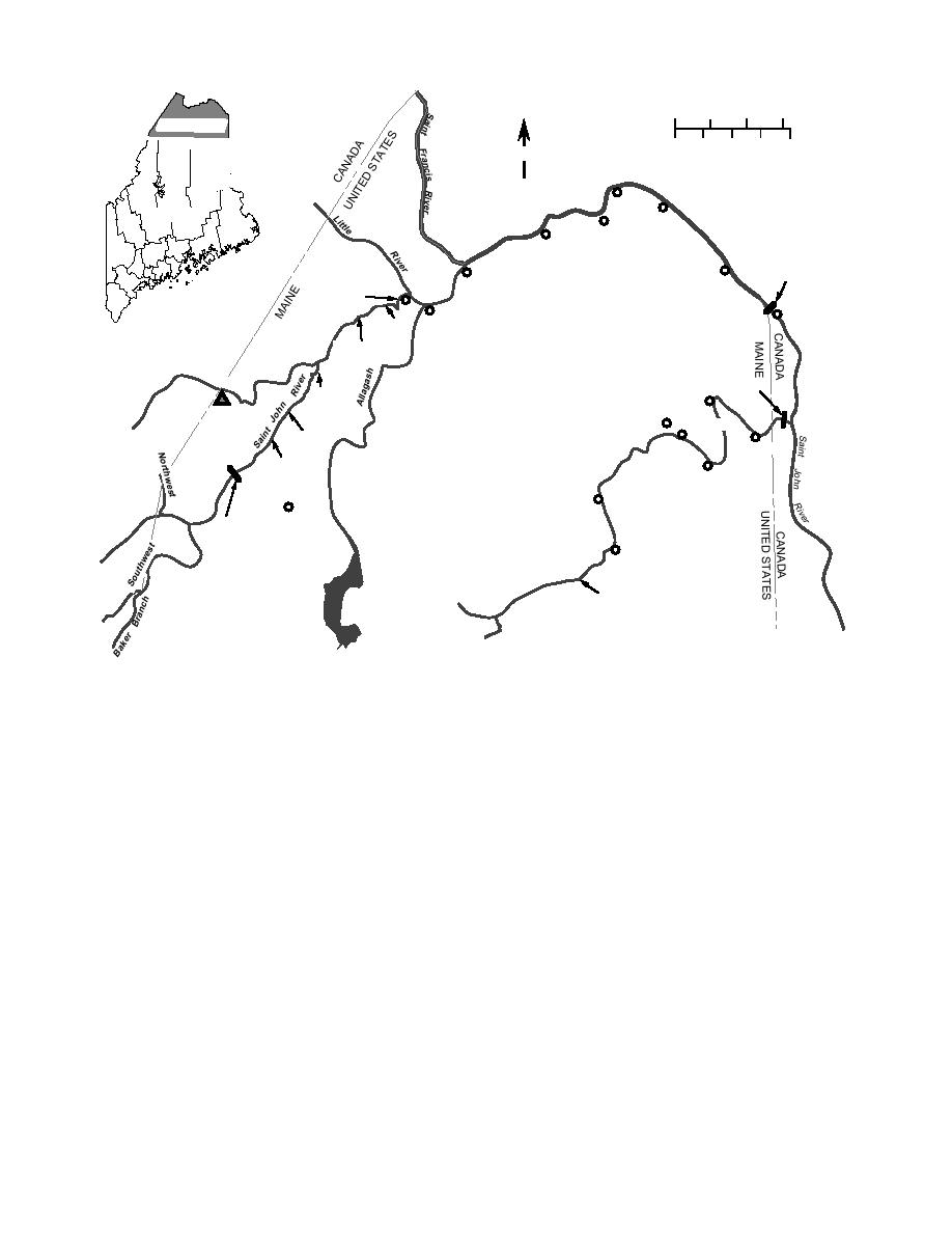
Figure 2. St. John River basin.
REVIEW OF HISTORICAL
Federal agencies, namely the Augusta District
HYDRO-METEOROLOGICAL DATA
Office of the U. S. Geological Survey (USGS), the
IN THE FORT FAIRFIELDCARIBOU AREA
Maine Emergency Management Agency, the
Maine Department of Transportation, the Maine
The Aroostook River is a tributary of the St.
River Advisory Group, the St. John River Flood
John River in northern Maine and western New
Forecast Center (Fredericton, New Brunswick,
Brunswick. The Aroostook River originates at
Canada), the International Paper Company,
the confluence of the Munsungan and Millinock-
Maine Public Service Co. in Presque Isle, and R.
et Rivers, and flows in a northeasterly direction
Gardner, a selectman of the town of Allagash,
for about 105 miles until its confluence with the
who is also a river observer for the New Brun-
St. John River at Aroostook Junction, New
swick Forecast Center. Local residents also sup-
Brunswick. The U.S.Canadian border is located
plied eyewitness accounts of past events, which,
about 5 miles upstream of the confluence, just
while incomplete and subjective, were still help-
below the town of Fort Fairfield, Maine. The
ful in interpreting the field observations made
Tinker Dam hydroelectric project is located 2
by CRREL personnel and in defining the ice
miles downstream of the international border.
processes during freezeup and breakup in the
upper St. John River and in the Aroostook River.
and an operating head of 85 ft. Above Tinker
In addition to field observations, we planned
Dam, the Aroostook River has a fall of 365 ft in
to review historical data. This review was, how-
just over 100 miles. The average annual precipi-
ever, limited to the Fort Fairfield area on the
tation over the Aroostook River watershed is
Aroostook River for which there were sufficient
about 37 in., with snowfall averaging about 100
reliable data on historical hydro-meteorological
in. There are no long-term streamflow records at
conditions; the review is described below.
3


 Previous Page
