7.5 Model Validation
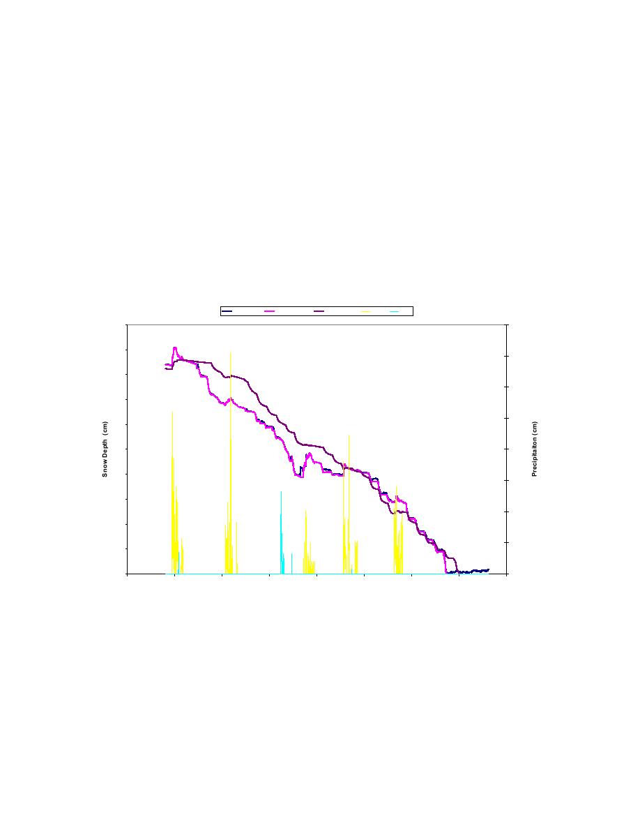
To test how well FASST predicts the snow depth, we compared the model results with
data gathered during the winter of 1997 in the Sleepers River, VT, watershed and during
the winter of 2003 for Buffalo Pass, CO, and Indian River, CO. The latter two data sets
are part of NASA's Cold Land Processes Experiment (CLPX). The results for Sleepers
River are plotted in Figure 7.1. FASST can run in two modes, one where FASST uses the
measured snow depth to self-correct the model predictions ("FASST, Yes") and one
where only initial snow depth is provided ("FASST, No"). The relative errors are 1% and
7%, respectively, both well within the accepted accuracy standard of 15% (Holcombe et
al. 2004). It can also be seen in Figure 7.1 that, for the most part, increases in snow depth
are accompanied by precipitation events. Increases in the measured values not associated
with snowfall are the result of blowing snow. FASST does not account for this at present.
Sleepers River, VT 1997
measured
FASST, Yes
FASST, No
snow
rain
0.04
100
90
0.035
80
0.03
70
0.025
60
50
0.02
40
0.015
30
0.01
20
0.005
10
0
0
80
85
90
95
100
105
110
115
120
Day of the Year
Figure 7.1 Comparison between the measured snow depth and the snow depth calculated
by FASST along with snow (yellow) and rain (blue) precipitation events for Sleepers
River, VT.
67


 Previous Page
