30
ERDC TR-04-1
lower infiltration capacities and higher rainfall intensities also result in higher
runoff coefficients (which express the proportion of rainfall converted to runoff)
in arid regions (Knighton and Nanson 1997). Given that soil types (Fig. 8) and
topography (Fig. 9) vary dramatically throughout the Southwest, even within the
same physiographic province (Fig. 2) or ecosystem province (Fig. 4), average
annual precipitation (Fig. 3) is equally variable and generalizations about runoff
patterns by province of limited value.
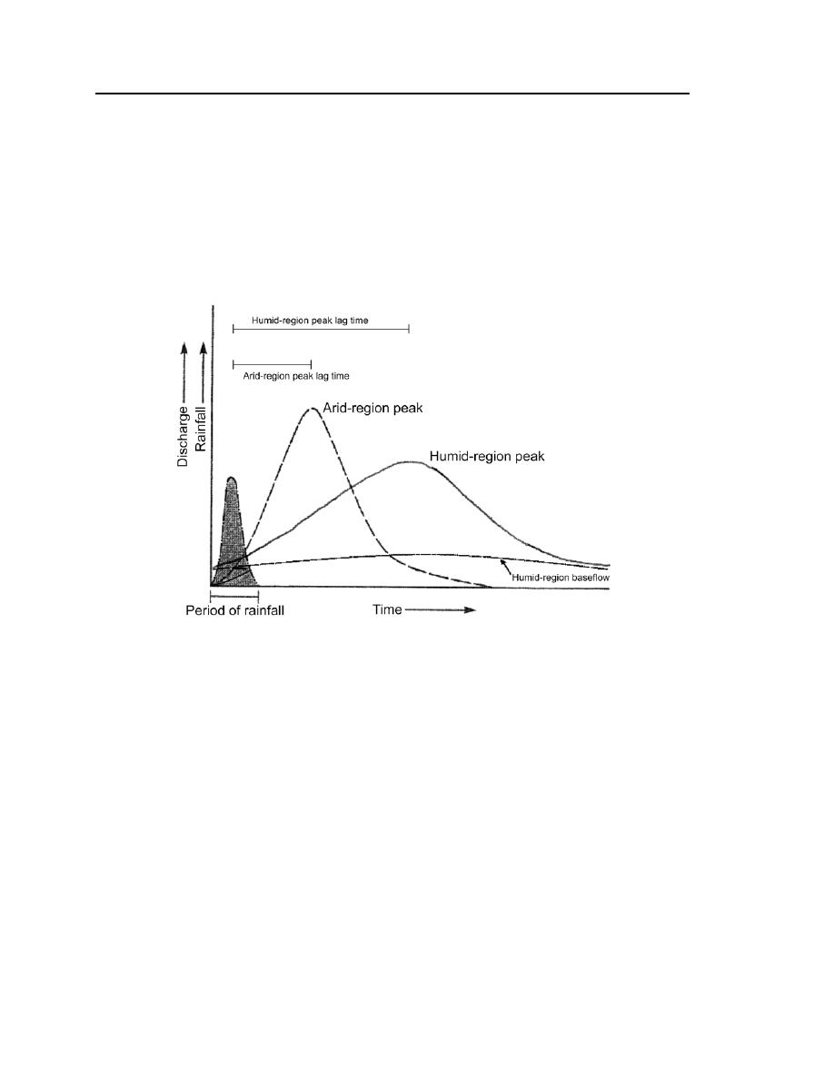
Figure 10. Comparison of idealized arid-region and humid-region
runoff hydrographs for the same rainfall event in watersheds of
similar size and shape.
Value and Limitations of Existing Maps for Understanding Runoff Patterns
Ecosystem province designations in the western U.S. (Bailey 1983, 1995)
provide the best basis for establishing hydrology-based subregions in the South-
west because ecosystem provinces are delineated using those factors that exert
the strongest influence on runoff patterns: vegetation, physiography, soils, and
climate (Table 4). Soils maps themselves also reflect runoff characteristics and
show variations within the same ecosystem province (Fig. 10).
In the Southwest, channel morphology and, as a consequence, the physical
features associated with the OHWM are frequently the result of extreme floods
(Graf 1988, Tooth 2000). Consequently, maps showing maximum rainfall


 Previous Page
