basis of accuracy and feasibility criteria. The difference equation formulation developed by
Holtschlag (1996) provided the basis for the filter presented in this report.
Purpose and scope
This report describes an extended Kalman filter that can be used to project the expected value
and the associated uncertainty of ice-affected streamflow. The filter was applied and evaluated on
the basis of historical climatological and streamflow data available near the St. John River at Dickey,
Maine, and near the Platte River at North Bend, Nebraska. The filter was restricted to forms that
could be automated and applied by use of data that have been routinely compiled and that could be
readily obtained in real time.
SITES OF DATA COLLECTION
Two sites for development and initial application of the filter were selected to represent a sample
of severe ice-backwater conditions in the U.S. In addition, the selected USGS streamflow gaging
stations, St. John River at Dickey, Maine (station 01010500), and Platte River at North Bend,
Nebraska (station 06796000), have a long historical record of streamflow data and are located close
enough to climatological data collection sites to support filter development and evaluation.
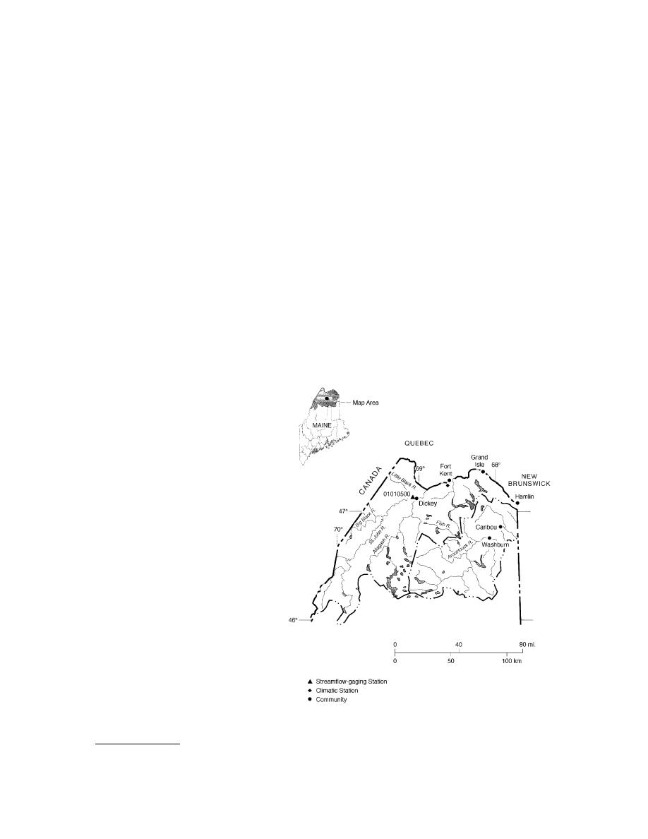
St. John River at Dickey, Maine, gage
The gage is located in northern Maine, about 160 miles north of Bangor, and about 9 miles south-
west of the border with Canada (Fig. 1). It is situated on the south (right) bank of the river, about 500
ft downstream from the bridge over
the St. John River near the end of
State Route 161. The drainage area at
the gage is 2680 mi2.
Daily streamflow data have been
compiled at the gaging station since
September 1946. Station records
through water year* (WY) 1995 show
a maximum instantaneous flow of
91,700 ft3/s on 29 April 1979, a mini-
mum daily mean flow of 135 ft3/s on
15 September 1948, and an average
of 4771 ft3/s. The stagestreamflow
relation is usually affected by ice
from early December through mid-
April. Minimum and maximum air
temperature data are recorded at the
Fort Kent climatological station,
which is located about 25 miles east
northeast of the gaging station (Fig.
1). Climatological data for the Fort
Kent station are published by the
National Oceanic and Atmospheric
Administration under station num-
ber 2878.
Figure 1. Selected streamflow-gaging and climatological sta-
In this report, 17 years of daily tions near the St. John River at Dickey, Maine.
* A water year is the 12 months from 1 October to 30 September of the next year. For example, WY 1990 runs from 1 October
1989 thorough 30 September 1990.
2


 Previous Page
