10
8
Stage
(ft)
6
4
Sensor 1
(Volts)
Sensor 2
2
(Volts)
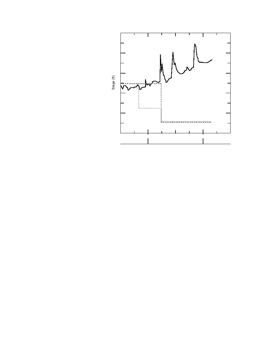
Figure 5. Comparison of signals from ice
0
1200
1200
1200
2400
2400
motion detector and stage gage at Nine
20 Jan
21 Jan
22 Jan
Mile.
Dam (17 miles). Another stable cover extended
the other 175 ft. This difference in length was
upstream from the dam to just below the bridge
introduced to account for the possibility that the
in Madawaska (or about 37 miles). This cover
ice may not break up simultaneously across the
consisted primarily of a single layer of very large
whole river width. We also felt that two pairs of
pans, except for a short reach at Grand Isle,
wires per detector would improve their reliabili-
where there had been some shoving. The river re-
ty, since there is always the possibility that one
mained open until just below Michaud Island in
pair may be damaged by chafing of the protec-
Frenchville or about 7 miles. Another stable cover
tive insulation because of minor ice motion, or
began at this location and proceeded up to about
other causes.
2 miles downstream of the Fort Kent bridge or
The voltage output from the motion detectors
nearly 10 miles. Above the bridge, the river was
at the Nine Mile bridge DCP is shown together
primarily open until the vicinity of the St. John
with the water level gage reading on Figure 5.
town line, a distance of about 10 miles. At this
The output indicates that the ice broke up be-
point, ledge outcrops initiated the downstream
tween 0615 and 0645 on 21 April, when stage and
edge of the final ice cover reach. Except as noted
discharge rapidly increased.
below, this iced-over reach extended to at least
the confluence of the southwest and northwest
FREEZEUP OBSERVATIONS
branches of the St. John River, 100 miles up-
stream from Fort Kent, where our observations
Both rivers began to freeze on 5 December,
ended.
when large amounts of frazil were being gener-
ated as the result of low air temperatures of 0F.
A partially open lead existed for about 1/2 mile
downstream of the St. Francis River confluence.
Temperatures remained low through 8 Decem-
ber, ranging from 10 to 20F, and rose to about
Additional open leads also were apparent at Big
15F through 11 December, when freezeup was
Rapids, Poplar Island Rapids, Schoolhouse Rap-
ids, Big Black Rapids and Priestly Rapids. Large
essentially complete. We made an air flight on 12
frazil accumulations were also observed, as
December to confirm the ice cover extent.
would be expected in these fast water reaches.
The majority of the remaining ice cover was
St. John River
formed primarily from the juxtaposition of single
On 12 December a freezeup jam existed from
layered floes.
the St. John RiverAroostook River confluence in
New Brunswick upstream for about 1/2 mile. The
On 16 December the Northwest Branch was
100% ice-covered up to the Daaquam River,
river was then open up to the base of Grand Falls
9


 Previous Page
