inundation of playas may not be readily available from
"...that line on the shore established by fluctua-
tions of water and indicated by physical charac-
conventional sources such as satellites or aerial photog-
teristics such as clear, natural, lines impressed on
raphy because of high costs and restricted access. Even
the bank, shelving, changes in the character of
if such information is readily available, determining juris-
the soil, destruction of terrestrial vegetation, the
dictional boundaries would be technically complex and
presence of litter and debris, or other appropriate
involve a clear understanding of the environmental con-
means that consider the characteristics of the
ditions during the time the data were collected. As will
surrounding area." (33 CFR 328.3[e])
be discussed below, the horizontal and vertical extent
Like many wetlands, both the soils and vegetation
of inundation varies in response to rainfall and ground-
of playas usually clearly contrast with those of adja-
water input, evaporation and percolation output, and
cent habitats. Like many wetlands, playas are wet only
wind-induced water movement.
intermittently. However, application of wetland hydrol-
This review summarizes the available technical
ogy, soil, and vegetation delineation protocols to playas
knowledge of possible indicators of OHW to be used
is moot because (1) The soils generally do not develop
in delineating playas in the arid southwestern United
recognized characteristics that might be used to deter-
States. It is based on the technical and "gray" literature
mine whether they were hydric in response to inunda-
(including delineations) as well as consultations with
tion. (2) The vegetation, particularly that which might
various Federal agencies involved with identifying and
be classified as obligate or facultative, does not char-
managing playas. This review, however, is not intended
acteristically grow on playa surfaces because of harsh
to provide specific guidance for delineating playas or
conditions. (3) Playas are by definition intermittently
to be interpreted as guidance provided by a Corps Dis-
covered with water, the extent of cover changing rapid-
trict or Headquarters. Rather, the scientific background
ly on both short- and long-term time scales (e.g., Kubly
and technical application needed for performing specific
1982), making any possible "frequency and duration"
delineations as well as case histories are reviewed such
criteria for hydrology problematic to assess.
that they can be applied as needed in a case-by-case
Detailed data on the temporal and spatial extent of
basis.
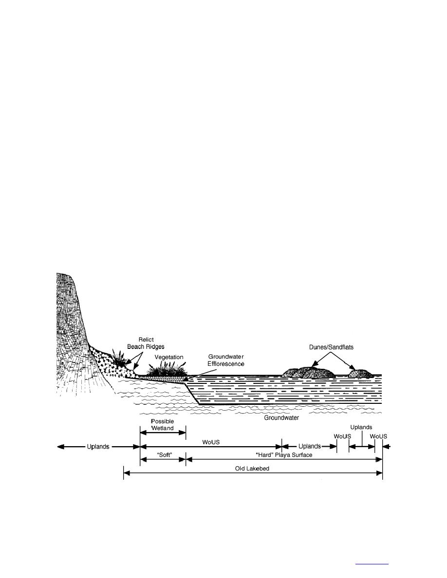
Figure 1. Conceptual diagram of a playa. Note that the area marked "soft" would be a wetland only if hydro-
phytic vegetation, hydric soils, and appropriate hydrology existed; it would be a non-wetland WoUS if it had
nonhydrophytic (or no) vegetation and nonhydric soils, but met the hydrology criteria. The area marked "hard
playa" ponds water but lacks both hydrophytic vegetation and hydric soils and therefore is considered a non-
wetland WoUS. Areas located above the dunes/sandflats are considered uplands.
2
to contents


 Previous Page
