about 2.8 km wide at the coast and
narrows inland. This subarctic region
has a transitional maritime to conti-
Knik Arm
nental climate, with moderate annual
Area D
Upland
temperatures (daily mean 1.9C;
minimum mean 2.2C) and precipi-
Pond Beyond
tation (330508 mm; Evans et al.
1972). ERF is inundated by the semi-
Bread Truck Pond
diurnal macrotidal fluctuations (9 to
11 m) in Knik Arm and the resulting
C-Pond
overflow from the Eagle River as it
meets the rising tide.
Area A
2
The Eagle River drains a 497-km
BRt.
basin in the Chugach Mountains,
B ravo
Racine
I
ridge
N
13% of which is covered by glaciers,
sland
yet it takes only a few percent gla-
cier cover to significantly modify the
runoff and sediment yield of the
Upland
Eagle River
P
drainage basin (e.g., Lawson 1993).
I ermanent Pond
Area B
Glaciers modify peak discharges, the
D termittent Pond
n
timing and volume of hourly, daily
rainage Gully
and seasonal discharges, the lag be-
tween precipitation and the increase
0
500 m
in runoff it causes, and long-term
trends in annual discharge of the ba-
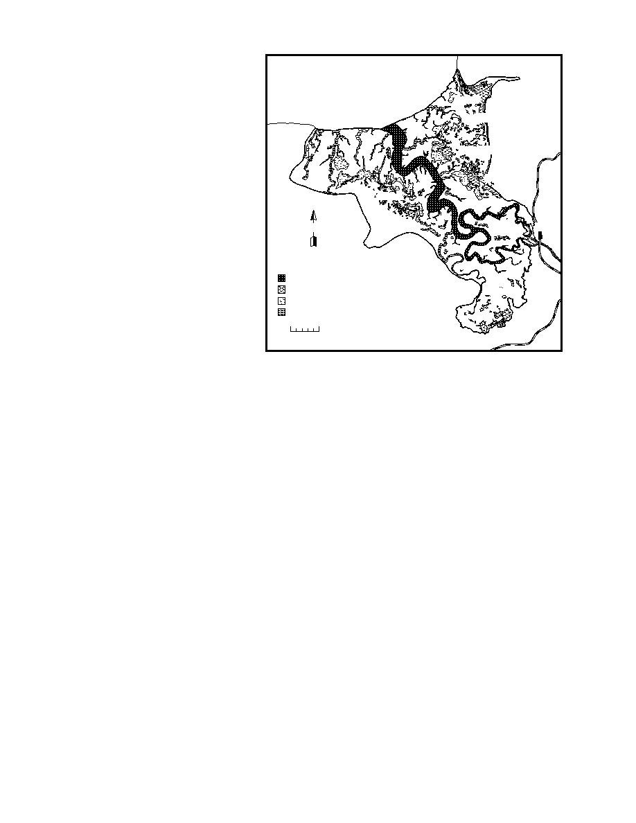
Figure 2. General distribution of ponds and the primary drainage
sin (e.g., Gurnell and Clark 1987,
system.
Lawson 1993).
Because of this glacial influence,
the primary melt season of July and August sees
discharge for these months ranged widely from
24.7 to 62.9 m3/s, with peak discharges exceeding
the maximum and peak discharges. River dis-
100 m3/s when rainfall-induced floods took place
charge and sediment fluxes vary daily, season-
ally and annually, primarily because of glacial
during high melt periods (USGS 1981).
meltwater fluxes (Lawson 1993). Massive quanti-
The Eagle River cuts approximately through
ties of silt- and clay-size particles are transported
the middle of ERF. The ponds and marshes pri-
in suspension by the large rivers draining
marily drain into it through vegetated channels
glacierized basins in the Alaska Range, Chugach
and drainageways, and through unvegetated tidal
Mountains and Kenai Peninsula (e.g., Susitna,
gullies that form a dendritic network (Fig. 2).
Knik and Matanuska river basins, Fig. 1) and are
Where gullies and drainageways do not follow a
discharged into Knik Arm. These materials can
dendritic course, their location appears to be con-
remain suspended in the Arm for extended peri-
trolled by relict drainage networks abandoned
ods and flow into intertidal wetlands during tidal
during the evolution of ERF (see Fig. 4a). The
inundation.
northern and coastal 20% of ERF is drained
Average discharge of Eagle River from 1966 to
through gullies that discharge directly into Knik
3/s, with a peak discharge
1981 was about 14.7 m
Arm. Surface water enters ERF from uplands on
3/s having occurred on 18 September
of 177 m
the east, west and southern boundaries; uplands
1967 (USGS 1981). During a 10-year observation
are composed of glacial deposits and are covered
by spruce and birch forests.
period (19661975), average monthly river dis-
As with other estuarine salt marshes in Cook
charge was observed to be lowest in February (1.4
3/s), with a minimum of 0.68 m3/s having oc-
Inlet (e.g., Hanson 1951, Vince and Snow 1984,
m
Rosenberg 1986), vegetation grows in zones that
curred between 29 January and 5 February 1974.
are commonly determined by elevation and re-
The highest monthly discharges came during July
lated to the landforms of ERF (Fig. 3). We believe
and August, with mean discharges of 46.9 and
3/s respectively. However, owing to the
this relationship to be a function of flooding fre-
43.5 m
quency, salt tolerance, drainage capacity and sedi-
variability in glacier melting and rainfall, average
2


 Previous Page
