involve emergency operations. Included in this
ated for each of the seven rivers. The present set of
responsibility are spatial data management, map
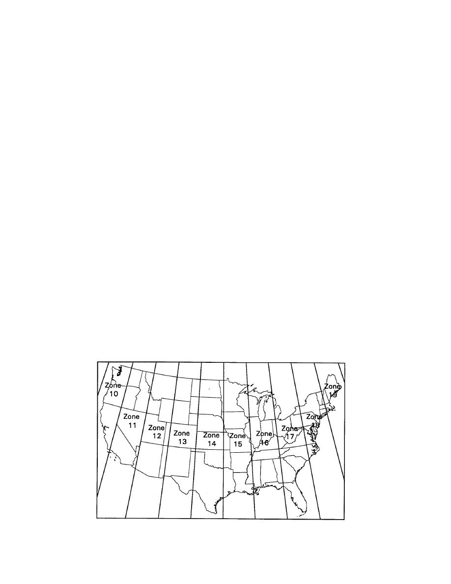
databases is in the Universal Transverse Mercator
generation and the coordination of acquisition of
(UTM) coordinate system based on the North
satellite images for analysis and display.
American Datum of 1983 (NAD83). The spatial
To provide support to the U.S. Army Corps of
database covers UTM zones 14, 15, and 16 (Fig. 2).
Engineers' response to the Midwest flooding, the
The seven river reaches covered by the spatial
RSGISC developed spatial databases containing
database are:
roads, railroads, hydrography, county boundaries
1. Mississippi River between St. Paul, Minne-
and inundation data for each of seven rivers locat-
sota, and Cairo, Illinois.
ed in the Mississippi River basin. This report de-
2. Missouri River between Sioux City, Iowa,
tails the development of these databases and the
and its confluence with the Mississippi River
methods used to create support maps during the
near St. Louis, Missouri.
emergency. In the next section, the present data-
3. Des Moines River between Boone, Iowa, and
base is described, including the data sources, and
its confluence with the Mississippi River near
the sensors used to acquire the inundation data
Keokuk, Iowa.
are discussed. The Application of the Spatial Data-
4. Kansas River between Manhattan, Kansas,
base section details the making of maps during the
and its confluence with the Missouri River
response phase, which had to be done while the
near Kansas City.
database was being developed. Problems and les-
5. Republican River between Haigler, Nebras-
sons learned are discussed. The Spatial Database
ka, and its confluence with the Kansas River
Distribution section describes the distribution for-
near Manhattan, Kansas.
mats of the database and the associated metadata
6. Grand River between Albany, Missouri, and
files, while the last section gives recommendations
its confluence with the Missouri River near
for the future directions of database development
Brunswick, Missouri.
for emergency management.
7. Illinois River between Valley City, Illinois,
and its confluence with the Mississippi River.
The Geographic Information System (GIS)
SPATIAL DATABASE
ARC/INFO software (Environmental Systems Re-
search Institute, Redlands, California) was used to
The overall spatial database is made up of data-
develop and manage the spatial database and cre-
bases for seven rivers in the Mississippi River ba-
ate maps for the seven reaches of river. This GIS
sin that were affected by flooding during the sum-
was chosen because of the availability of pro-
mer of 1993 (Fig. 1). Separate databases containing
cessed ARC/INFO format data within the Corps
roads, railways, hydrography, county boundaries
of Engineers and other collaborative agencies.
and, when available, inundation extent were cre-
Figure 2. Universal Transverse Mercator (UTM) zones for the continental United States.
3


 Previous Page
